DENVER – Rain and snow in the central and northern mountains and across the eastern half of Colorado improved drought conditions and snowpack levels over the past week, but the same cannot be said for southwest Colorado.
Part of eastern Jackson and western Larimer counties saw drought disappear over the past week, according to the May 31 report from the U.S. Drought Monitor released Thursday. The data was compiled on the first day of a two-day precipitation event earlier this week.
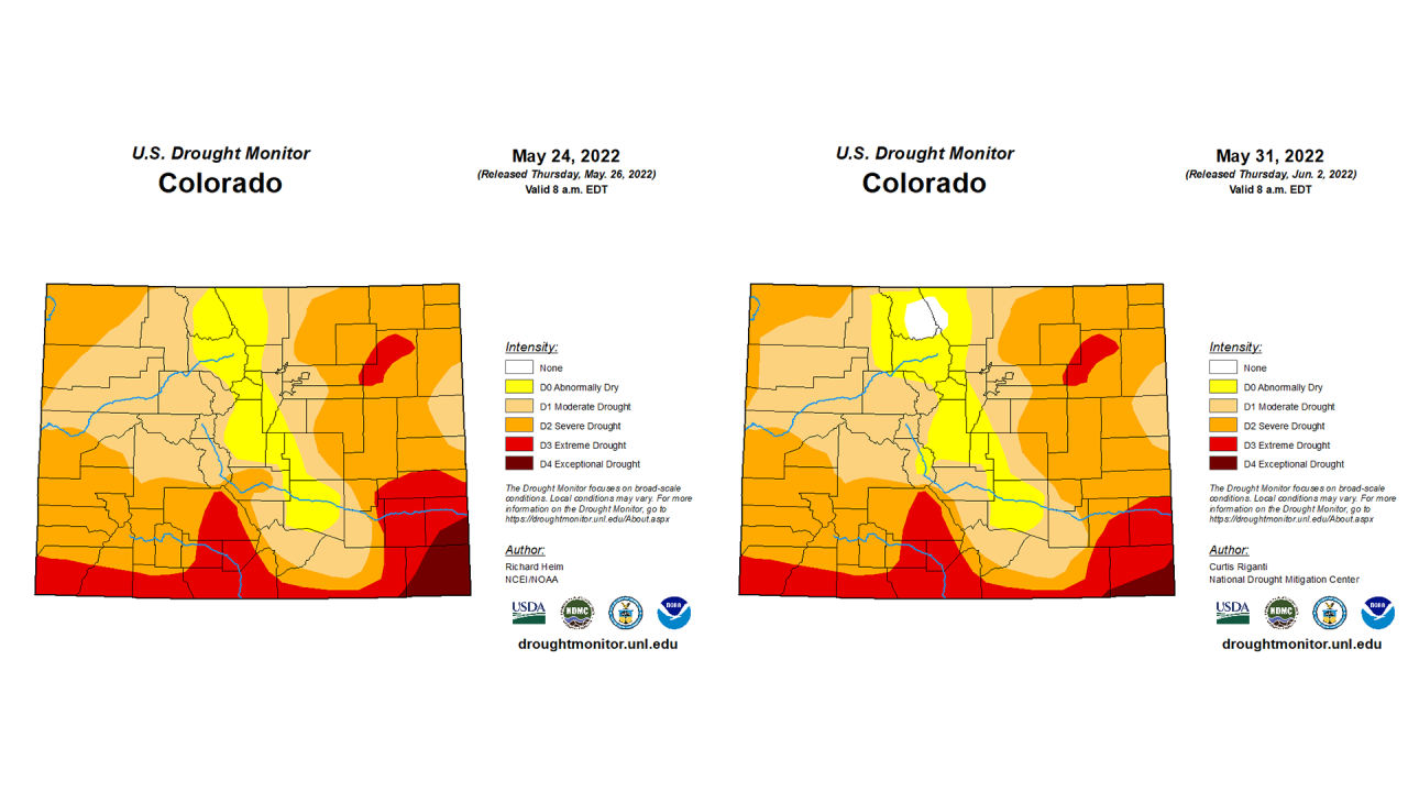
The week of Nov. 16, 2021, was the last time any part of Colorado was drought-free. One hundred percent of the state has been at least abnormally dry in the six-plus months since then.
Over the past week, drought conditions also improved in Fremont (severe drought to moderate drought) and Chaffee (moderate drought to abnormally dry) counties, and in Baca and Prowers counties, which slid back in some areas from exceptional to extreme drought.
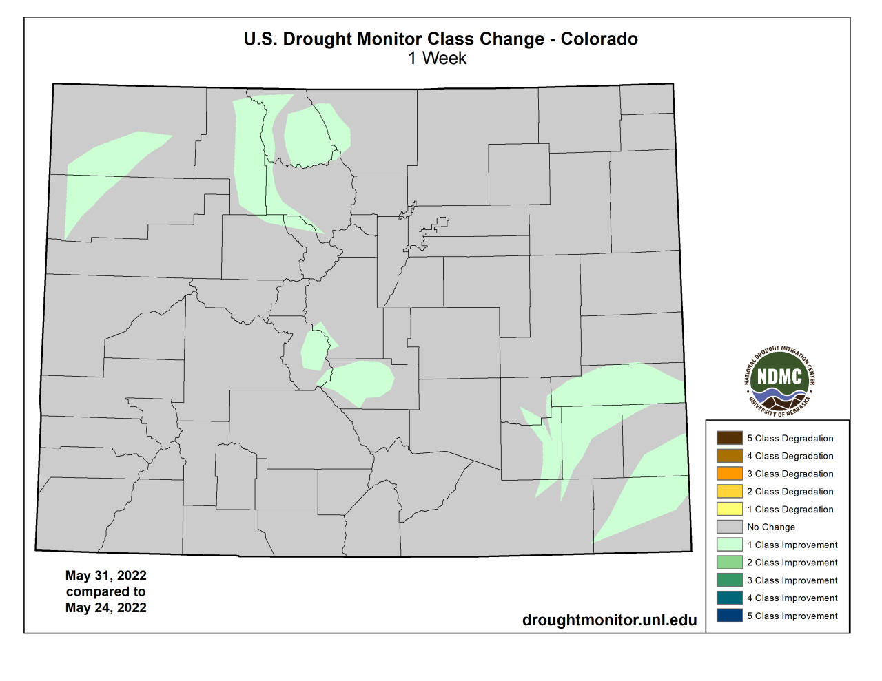
Next week’s report has the potential to show even further improvements, as the rain and snow continued over much of the state into Wednesday afternoon, the day after this week’s data was compiled.
According to CoCoRaHS data, much of the area including the Denver metro and foothills west of Golden received 1 and 1.5 inches of precipitation, with more than 5 inches of snow in the foothills, in the May 31-June 1 storm. At Denver International Airport, 0.52 inches of rain was measured on Wednesday alone.
The storm pushed Denver up to 6.06 inches for the year so far, putting 2022 above the average for this time of year of 5.64 inches. And there is more rain possible in the area into early next week.
But southwest Colorado did not see the same benefits. Mesa Verde National Park, for instance, is now nearly 4.5 inches of precipitation below normal for the year so far, receiving just 2.93 inches compared to 7.31 in a normal year.
Most of southwest Colorado remains in extreme or severe drought, and there is little sign of any major precipitation in the area over the next week.
The story is much the same with Colorado’s snowpack, as the storm greatly benefitted the northern half of the state but left much to be desired in southern and southwestern Colorado, where the snowpack is nearly gone.
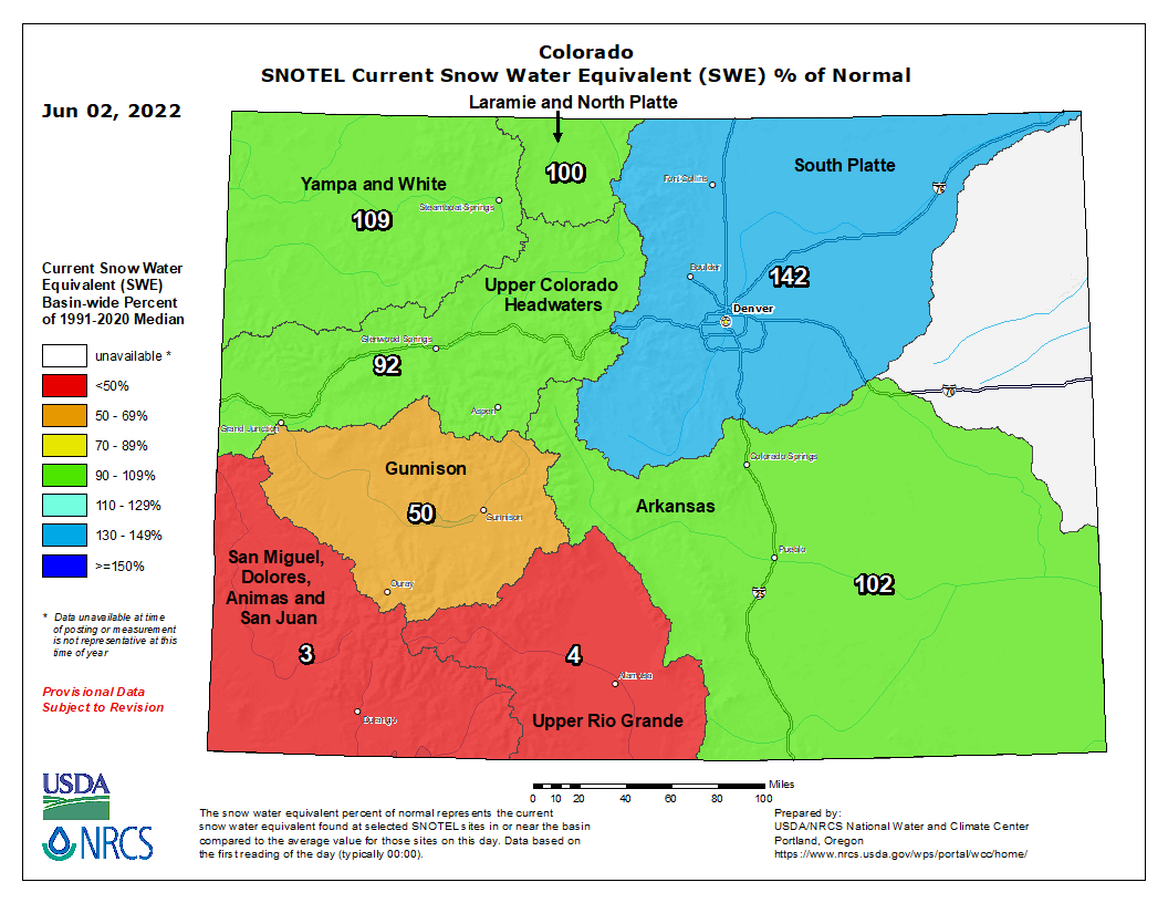
Statewide, the snowpack was 102% of median levels compared to the 1991 to 2020 period as of Thursday, according to U.S. Department of Agriculture and Natural Resources Conservation Service data.
But that average of the eight basins is buoyed by the snow in northern Colorado, including this week’s snowstorm. The South Platte (149%), Yampa and White (110%) and Laramie and North Platte (109%) basins were all above median levels for June 2. The Arkansas basin was also above median levels, at 113% of median.
But as one moves south and west, those numbers shrink significantly. The Upper Colorado River basin was at 79% of median levels Thursday and the Gunnison was at 54% of median levels.
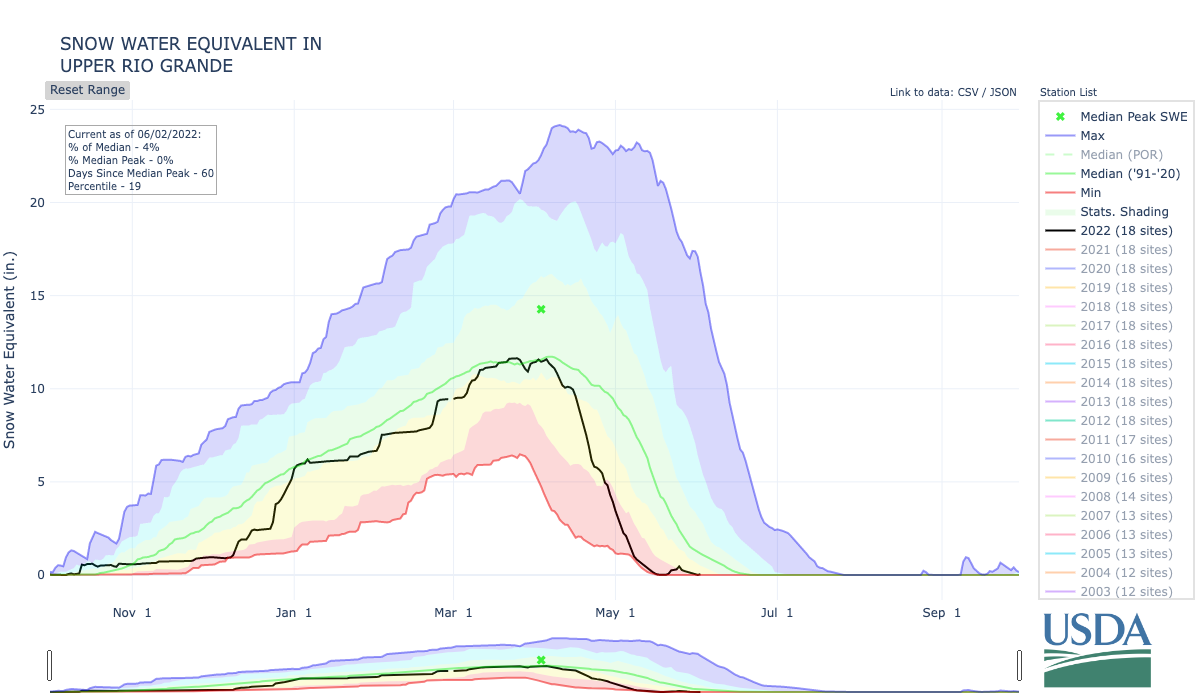
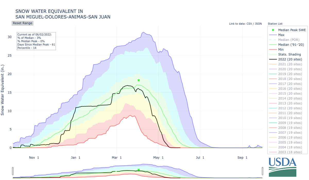
And the Upper Rio Grande (4% of median) and San Miguel, Dolores, Animas, and San Juan (3% of median) basin snowpack is nearly gone entirely. Both showed. 0.0 inches of snow-water equivalent on Thursday, according to the USDA/NRCS data.
The Climate Prediction Center is showing above-average temperatures and near normal precipitation over the next two weeks for Colorado. But the three-month outlook shows well-above normal temperatures across the whole state and below-normal precipitation chances.
You can always watch 24/7 weather, radar and news updates on the free Denver7+ app on your TV.


