DENVER — Well-below normal temperatures will continue overnight and impact your Friday morning commute, the National Weather Service warned late Thursday.
Winter weather advisories are already in effect in Larimer and Weld counties and the northern Front Range foothills and mountains and will remain in effect until 9 a.m. Friday.
The advisories are also in effect for the Denver metro area, plains just east of Denver and Palmer Divide.
MORE: What to expect today | Live updates | Lisa's forecast | Weather page | Denver7+ weather stream | Radar | Traffic | COTrip | Closures
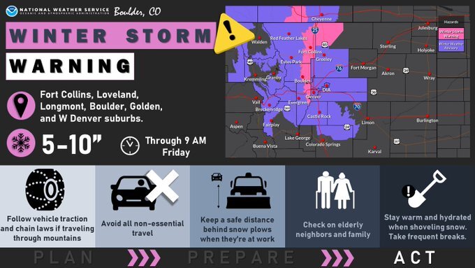
The National Weather Service upgraded the Fort Collins, Boulder, Golden, Arvada, Longmont and Lakewood areas to winter storm warnings around 8:30 a.m., for an additional 4-10 inches of snow through Friday morning on top of what has already fallen.

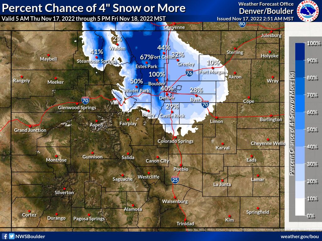
The eastern metro area is expected to see 2-6 inches of snow in the storm, with higher amounts in Boulder and Larimer counties at higher elevations. In the foothills and mountains, 4-10 inches of snow could fall by Friday morning, according to forecasts from Denver7 and National Weather Service meteorologists.
By 6:45 a.m. Thursday, light snow was falling along I-76 in the Fort Morgan area, Boulder County, Greeley and Wellington. By 7:50 a.m., snow was already falling across northern Colorado, and it was widespread by 9 a.m. The main part of the system will move south from Wyoming through the day Thursday.
Temperatures started in the upper 20s Thursday morning but will continue to drop through the day. By sunset, most of northern Colorado is likely to be in the teens, and lows overnight will drop into the single digits across the area — with below-zero temperatures in the foothills and mountains.
Snow fell on the back half of the morning along the I-25 corridor, and there is expected to be a lull in the early afternoon, according to the NWS in Boulder. The snow is expected to be more consistent through the day north of the metro area.
But snowfall is expected to pick up in the afternoon and into the night, and banded snow is expected in some areas that could increase snow totals in certain pockets. The NWS said some areas could see 20:1 snow-to-liquid ratios.

The eastern plains could see a trace to 3 inches of snow, according to the NWS. Some of the foothills south of I-70 and Summit County might be on the edge of the main area of precipitation.
Because of the cold overnight temperatures, Friday morning’s commute will likely be slow-going, though only light snow is expected Friday morning. Temperatures Friday will stay in the 20s on the plains and single digits and teens in the foothills and mountains, and overnight temperatures into Saturday are likely to again dip into the single digits.
❄Snow continues overnight, tapering off Friday morning. 🚗Travel will be difficult in areas overnight, especially near the foothills of Boulder and Jefferson Counties. The morning commute will also be slick.
— NWS Boulder (@NWSBoulder) November 18, 2022
🥶Cold below normal temperatures expected. #COwx pic.twitter.com/CuSwuBaflg
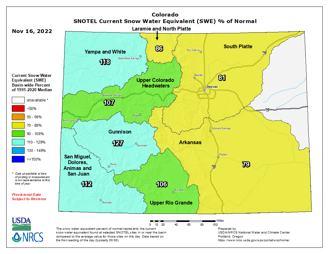
Snowpack statewide was 105% of median levels as of Thursday morning ahead of the storm.

The five westernmost basins in Colorado are all above 100% of median levels. The three eastern most basins – the Laramie and North Platte (86%), South Platte (81%) and Arkansas (79%) – were all slightly below median levels ahead of the storm, though the South Platte and Laramie and North Platte basins will likely see boosts from the storm.
Denver has already received 6.4 inches of snow so far at Denver International Airport – well above last year, when it did not snow until December.
Stay with the Denver7 weather and news teams for the latest on the storm as it affects northern Colorado Thursday and Friday. You can also get 24/7 weather updates on Denver7+.


