


UPDATE (Tuesday, 11:15 a.m.): We have a new story looking ahead to tomorrow's storm based on updated forecasts. Click here for the latest.
———
DENVER – Another snowstorm is expected to move into Colorado Wednesday and bring snow to the mountains and the metro area.
There is still some uncertainty as of Monday about the exact timing and intensity of the storm. But after temperatures reach the mid-50s on Tuesday, a cold front is expected to move across the northeastern part of the state Tuesday night and drop high temperatures Wednesday to the low 30s, according to the National Weather Service in Boulder.
The snow will start sometime Wednesday morning in northern Colorado and make its way south through the state on Wednesday. As of Monday, the system had slowed, and forecasts showed the snow might now arrive in the metro area until the late morning or early afternoon, according to the NWS.
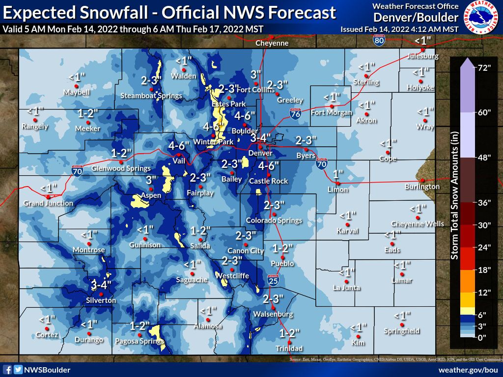
Mid-afternoon to midnight Wednesday appears to be the prime time for snow this week as of Monday afternoon. Models on Monday were showing generally 2-6 inches in the metro area, with higher amounts in the foothills and Palmer Divide. But the northern and central mountains should get a good shot of snow, and most of Colorado appears likely to see some precipitation from the storm.
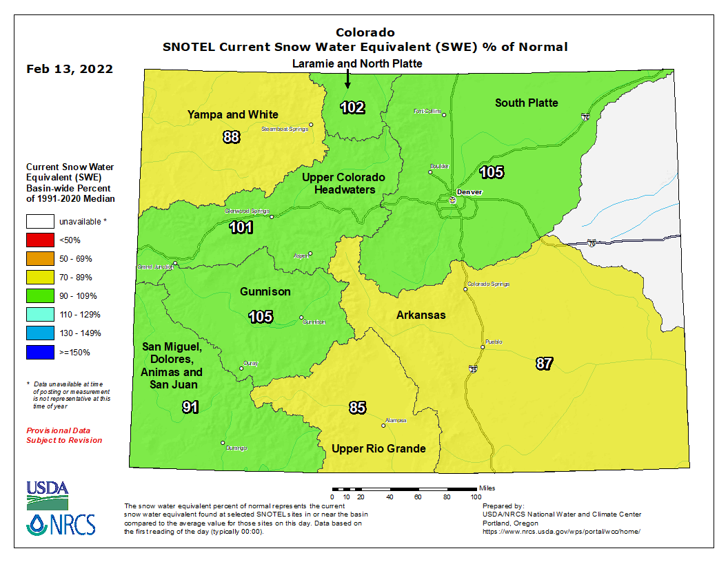
Snowpack statewide sat at 95% of median as of Monday and has leveled off over the past month following a snowy end of December and start to the year in Colorado’s eight river basins.
The Gunnison (105%), Upper Colorado Headwaters (101%), Laramie and North Platte (102%) and South Platte (105%) basins were all above median levels Monday
But the San Miguel, Dolores, Animas and San Juan (91%), Yampa and White (88%), Upper Rio Grande (85%), and Arkansas (87%) basins were all below median levels.
Denver has already received 24.7 inches of snowfall this winter season and 1.21 inches of precipitation since Jan. 1, according to the NWS.
As of last week, all of Colorado was still experiencing at least abnormally dry conditions. Eighty-eight percent of the state was experiencing moderate drought or worse, and 66% of the state was seeing severe drought or worse, according to the U.S. Drought Monitor. Just 8.5% of Colorado was experiencing extreme drought – down from 22% of the state during the last week of December.
A study published Monday in the journal Nature Climate Change found the American West is now the driest in the last 1,200 years amid a historic megadrought – topping one from the late 1500s. The study calculated 42% of the megadrought can be attributed to human-caused climate change.
You can always watch 24/7 weather, radar and news updates on the free Denver7+ app on your TV.


