DENVER – The National Weather Service in Boulder is warning of “extremely dangerous” fire danger on Friday amid a major weather event to top off a week marked by windy, warm weather and wildfires across Colorado.
The wildfire threat will continue Thursday after several fires on Wednesday, including one in Monte Vista that destroyed several structures. High temperatures are expected to be 10-15 degrees above normal Thursday, according to the National Weather Service.
But on Friday, red flag warnings will be in effect from 11 a.m. to 9 p.m. from the foothills all the way across the eastern plains.
It's not often we see "Extreme" fire weather conditions, but Friday will be one of those days!
— NWS Boulder (@NWSBoulder) April 21, 2022
Avoid any and all outdoor activities that may produce a spark.
"Let's all do our part - don't let it start!" #COwx pic.twitter.com/8wkCbMHqWT
Winds across the area are expected to be sustained between 25 and 40 miles per hour out of the south, with gusts between 40 and 60 mph. The winds will increase Friday morning and be strongest in the afternoon into the evening.
Humidity levels are expected to be in the single digits to low teens, which, combined with the winds and temperatures nearing 80 degrees, will create prime conditions for wildfires to spread quickly.
“Fuel conditions are still ripe with only limited and shallow green-up in some areas. Unfortunately, should a fire start it would be difficult or impossible to control given these conditions which would last into early evening,” the NWS said Thursday, warning people to have go bags ready and that blowing dust and wind could also lead to road closures – especially on the plains east of Denver and Fort Morgan.
There is also a chance for thunderstorms on the far northeastern parts of the state Friday evening depending on conditions, according to the NWS.
Stage 1 fire restrictions are already in place for more than a dozen Colorado counties including Adams, Arapahoe, Boulder, Douglas, and El Paso counties, as well as for most of Central Colorado and parts of the Western Slope and the Eastern Plains.
Meanwhile, the mountains will see snow Friday night through Saturday, with 3-8 inches possible.
It will be cooler over the plains on Saturday and Sunday, with a chance of rain on the back half of Sunday. But next week is expected to be dry and warm again, which the NWS said Thursday “could bring enhanced fire weather conditions back into the picture.”
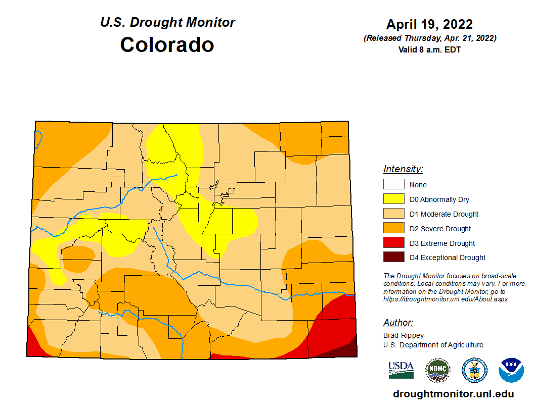
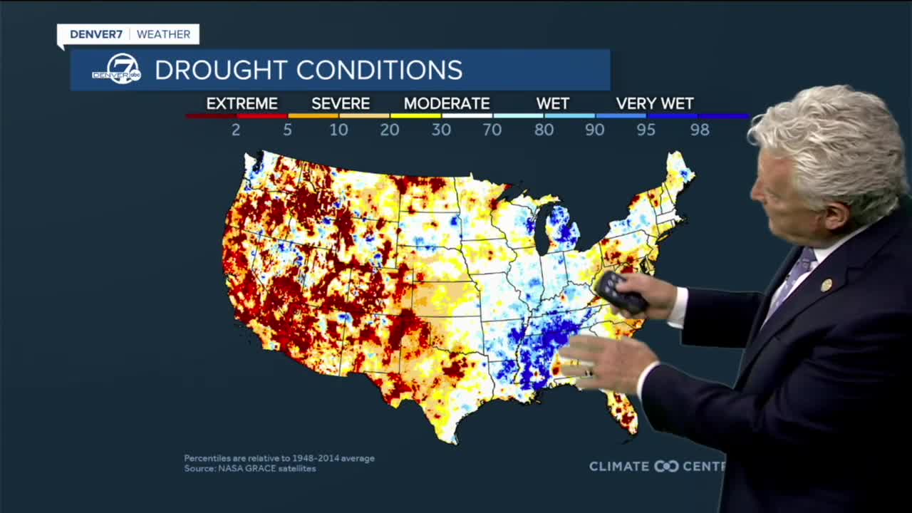
Drought conditions worsened in Colorado over the past week, according to the U.S. Drought Monitor, and moderate drought crept back into Denver, which had been only abnormally dry for the past couple weeks.

As of this week, 87% of Colorado is experiencing moderate or worse drought. Thirty-three percent of the state is seeing severe or worse drought conditions, while 4% of the state – in the far southeast portion of Colorado – is seeing extreme or exceptional drought conditions.
The snowpack has also dropped this week and now sits at 85% of its median levels between 1991 and 2020.
Four river basins – the Laramie and North Platte (95%), Upper Colorado Headwaters (93%), Gunnison (90%) and South Platte (90%) – were at or above 90% of median levels as of Thursday.

The Yampa and White (87%), Arkansas (71%), Upper Rio Grande (71%), and San Miguel, Dolores, Animas, and San Juan (68%) basins were all further below median levels.
Friday’s critical fire danger will also come on the same day the state Division of Fire Prevention and Control delivers its 2022 wildfire outlook to Gov. Jared Polis and the public, of. which Denver7 will have in-depth coverage.
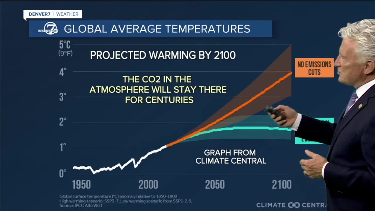
You can download a free copy of Denver7 Chief Meteorologist's 'The World's Littlest Book on Climate.' for 10 facts in 10 minutes about CO2.
You can always watch 24/7 weather, radar and news updates on the free Denver7+ app on your TV.


