DENVER – It may have been mild for December, but that all changed quite rapidly with an blast of arctic air arriving in the state bringing dangerously cold temperatures and highs below freezing – something Denver hasn’t seen in nearly a decade.
Beginning Wednesday between 4 p.m. and 7 p.m., a strong northwest flow drove an arctic airmass bringing bitterly cold temperatures to north central and northeast Colorado through Friday morning, according to the National Weather Service in Boulder.
"We expect a quick drop from the 40s to around 10 degrees in about an hour, then down below zero a couple hours later, by 8 p.m. in the north and 10 p.m. in the south," NWS officials said in their latest forecast discussion.
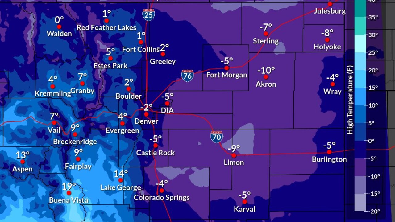
Lows on Wednesday night for Denver are forecast to be -16° F, with temps dropping even lower for the Eastern Plains. Thursday highs will be in the single digits and below zero for both the Urban Corridor and the Eastern Plains.

The last time Denver had a high below 0° F was February 5, 2014, according to the NWS. The last time it was forecast to be -5° F (as it’s currently forecast to be out of DIA) was December 21, 1990, when the high only reached -7° F.
A Wind Chill Warning is in effect ending Friday at 11 a.m. for portions of central, east central, north central and northeast Colorado – basically everything east of Steamboat Springs all the way through the Nebraska-Kansas state border lines – due to “dangerously cold wind chills” that could be as low as 50 degrees below zero across both the plains and mountains, NWS officials said.
Wind chills for the Urban Corridor and mountain parks will be “a little bit warmer,” between 20 to 30 degrees below zero, according to the NWS.
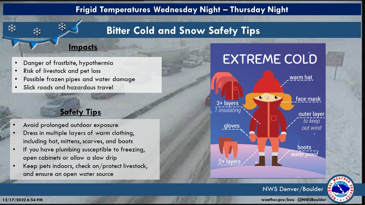
"Exposed skin may become quickly frostbitten or frozen. Wind chill values may fall to extremely dangerous levels. The dangerously cold wind chills could cause frostbite on exposed skin in as little as 10 minutes," NWS forecasters warned, as they advised Coloradans to avoid prolonged outdoor exposure and to dress in multiple layers of warm clothing. For pet and ranch owners, the NWS advises to keep pets indoors and to check and/or protect livestock and ensure an open water source.

Light to moderate snow is possible behind the arctic front, with about one-to-three inches across the plains, foothills and mountain parks and between three-to-six inches of snow in the mountains. The Park, Rabbit Ears and northern Front Ranges could get up to 12 inches of snow, the NWS said.
In the Denver metro, the snow should start falling by about 6 p.m., lasting into early Thursday morning.

Denver7 | Weather
Dangerous wind chill this week across Colorado. Use this guide to prepare
Most snowfall will end early and there may be some ice crystals falling but no actual or impactful snowfall is forecast, the NWS said. There will be slick roads and hazardous travel Wednesday and Thursday night, however, so drivers are asked to be vigilant if going out at all during this period of frigid weather.
“Winds will be persistently breezy and it will remain very cold through the day with the new arctic airmass over snow cover, with dangerous wind chill through the night,” forecasters said.
By Friday, the arctic airmass will begin moving east and a warming trend will begin. Highs are expected to be about 20 degrees warmer but it will still be below freezing, NWS officials said.
A warming trend continues into Christmas Eve with temperatures back up a few degrees below normal, with highs in the 40s and 50s for the Christmas weekend.
Weather Links
MORE: Hourly forecast | Latest forecast | Radars | Traffic | Weather Page | 24/7 Weather Stream
Stream live, current temperatures plus radars across Colorado anytime, free: Weather 24/7 streaming on the free Denver7+ app on your TV. Or watch on your computer or mobile phone anytime.


