


LOVELAND, Colo. — Rainfall triggered a flash flood warning for the Alexander Mountain Fire burn area on Wednesday afternoon, according to the National Weather Service (NWS) in Boulder.
At 2:41 p.m., NWS said "debris and rock flows were already occurring," and urged people to move to higher ground immediately.
⚠️FLASH FLOOD WARNING⚠️
— NWS Boulder (@NWSBoulder) August 7, 2024
Significant Flash Flooding expected in areas of the Alexander Mountain Burn area.
* Debris and rock flows already occurring.
* Move to higher ground immediately!
* Avoid draws, ditches, and gullies. #COwx pic.twitter.com/J5Q0SnHv0e
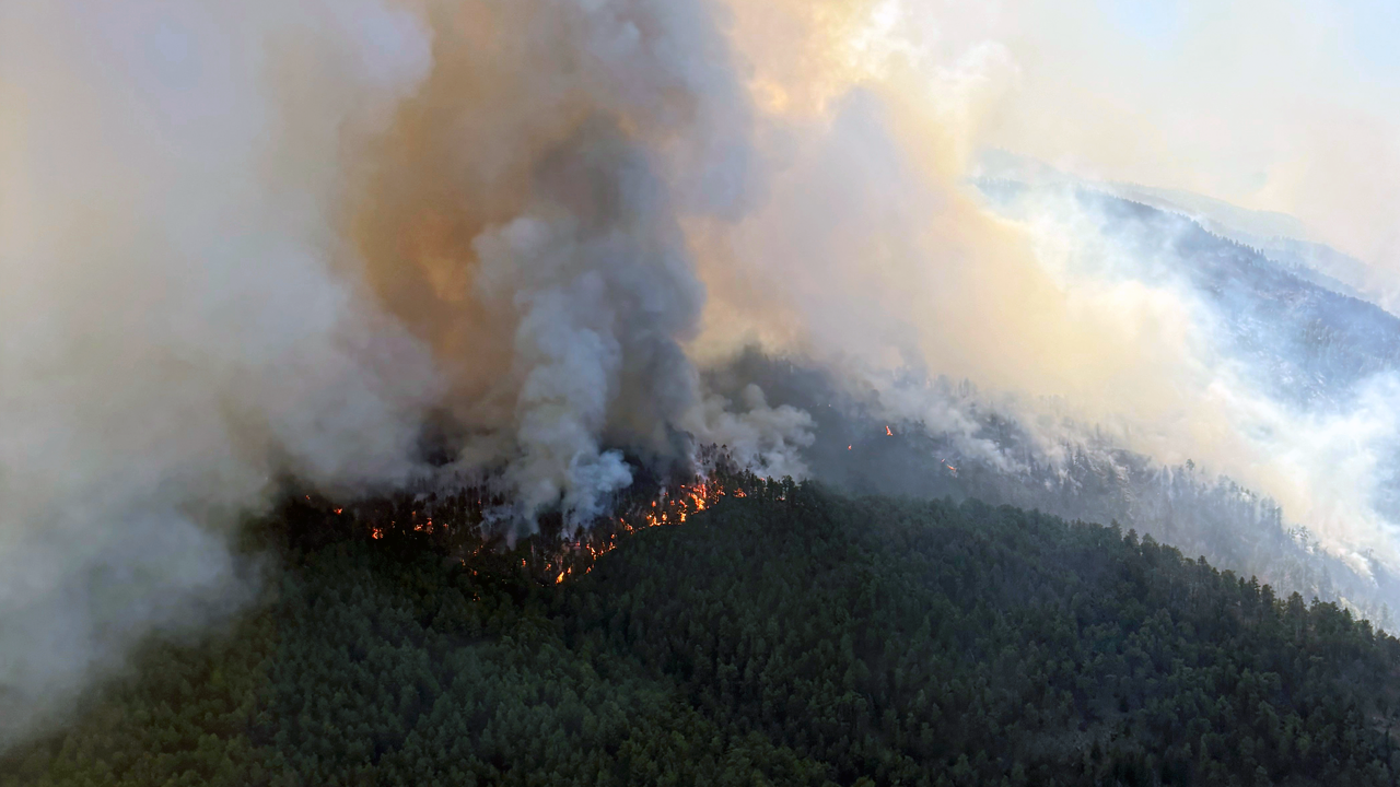
The potential for flooding comes after firefighters across Colorado welcomed any bit of rain this week, following a hot and relatively dry weather pattern adding fuel to more than four wildfires, including the Alexander Mountain Fire west of Loveland.
However, too much rain can cause dangerous issues over previous wildfire burn scars.
Tracking rainfall and potentially dangerous weather patterns is exactly what the Incident Meteorologists working with the Southwest Area Incident Management Team are still doing, despite fire containment increases.

"My primary job on the fire is to support the firefighters out there, the crews, even the folks in camp, just to make sure that they know if there's any high water coming, lightning, ace or changes in the weather," said Kari Fleegel, incident meteorologist assigned to the Alexander Mountain Fire.
She has shifted her concern from fire to water.

"One of the concerns is any sort of mud, dirt, debris, any sort of trees, boulders that could slide down the hill from the slopes that have been really impacted by the fire," she said.
Fleegel said she looks at weather radar, and even communicates with the local National Weather Service, to determine when and if alerts need to go out.
"We look at the slope, how steep it is, how fast the rain could fall down from there, as well as any other concerns that, like burn severity, could definitely change how fast water can flow off the slope," Fleegel said.
Typically, only a half an inch of rain in less than one hour can cause flash flooding over terrain burned by fires. That’s because the vegetation and soil that normally helps absorb rainwater is scorched or burned away. Therefore, water can build up on the surface area and carry excess dirt, debris and burned vegetation down a hill or downstream.
The severity of flash flooding depends on how large the fire was, how steep the terrain is and the rate of precipitation. However, if you live in an area vulnerable to flooding, downhill or downstream from burned areas, be prepared to leave. Do not necessarily wait for a flash flood warning to be issued.
Current fires in our state can be seen here.
While Fleegel and other meteorologists work to gather the latest information on weather patterns in and near the Alexander Mountain Fire burn area, others are gearing up to help in other ways.

"When this disaster hit, we were able to step in," said Ashlee Schmitt, mobilizing director for Serve 6.8.
The nonprofit will give free sandbags to anyone impacted by the Alexander Mountain Fire and the other wildfires that recently broke out in the state.
"We're looking about, I think it was the 100 tons of sand that we're going to be bringing in initially," Schmitt said. "We're looking anywhere from 5,000 to 6,000 bags right now for this year."
The sandbag distribution is scheduled to begin Saturday, Aug. 10.

For more information on that distribution, click here.
While newer burn scars are the most prone to flooding, flash flooding can still occur years following a major fire.

Some of the largest and most recent in our state include the Cameron Peak, East Troublesome and the Grizzly Creek Fire burn scars.
The Grizzly Creek Fire ran along Glenwood Canyon off Interstate 70 and the road has seen multiple flood events, slides and closures since it scorched around 32,000 acres in 2020.
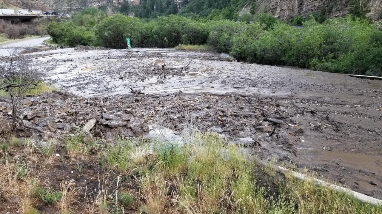
If there hasn’t been a lot of regrowth following a fire, or human mitigation done, excess rain can lead to increased damage to roads, bridges and homes in the way of fast moving water.
Our next front is set to bring showers and thunderstorms from Colorado’s mountains to the Eastern Plains Thursday and Friday. While we welcome the moisture, just be aware there will be an elevated risk for flooding over burn scars.

Today's Forecast
