DENVER — Because of the heavy rain threat tonight, the Denver7 weather team is issuing a Weather Action Day.
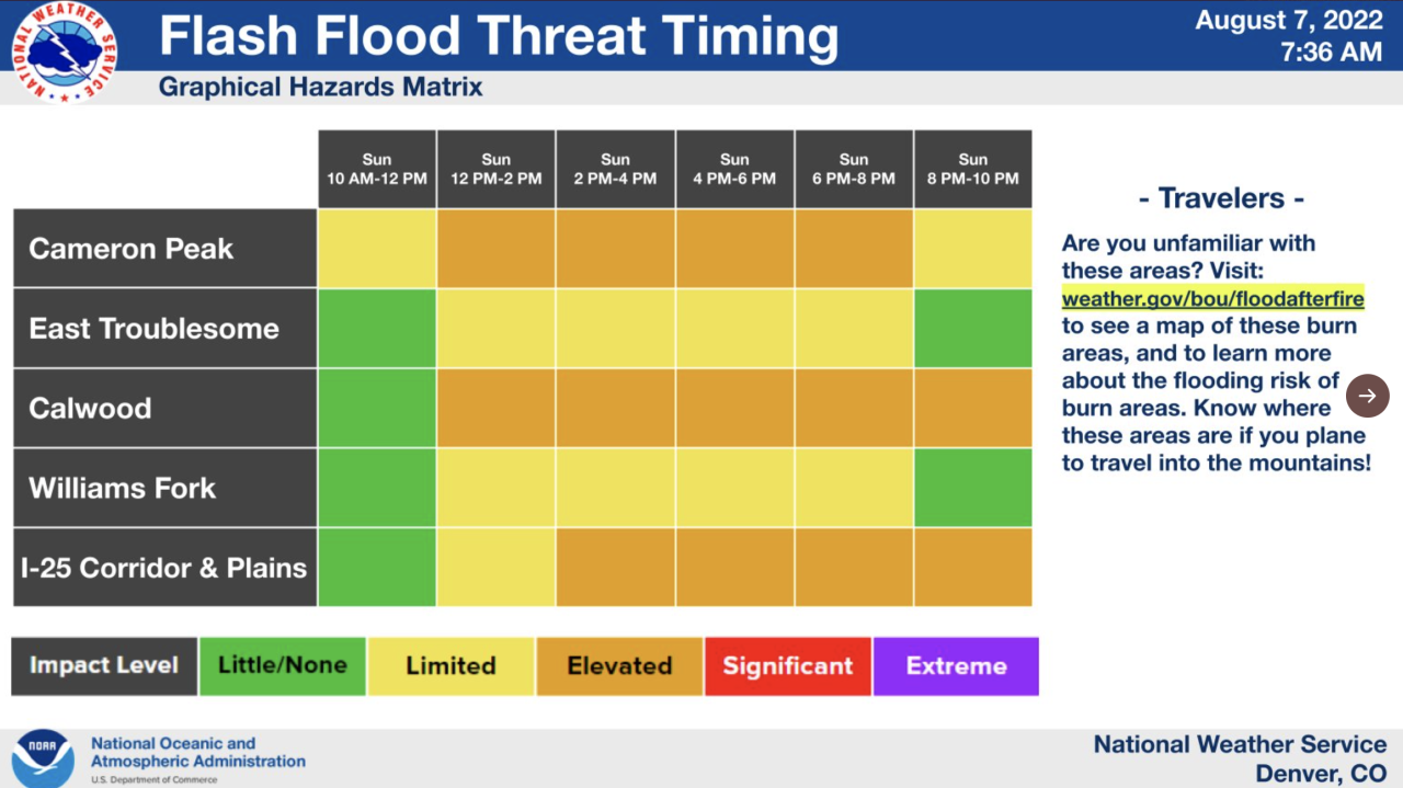
Heavy rain is expected Sunday evening as a Flood Watch has been issued metro Denver and the entire Front Range. The Flood Watch lasts until 11pm.
Strong thunderstorms could dump between 1-3" of rain in under an hour as they move through tonight.
Be ready for rapidly changing weather conditions as storms develop this afternoon. Be sure to never drive over any flooded roads. It take a very small amount of water to strand or wash away your car.
The Cameron Peak and Calwood burn scar areas are included in the Flood Watch which goes into effect Sunday afternoon through the evening.
For Monday we have a chance for scattered afternoon storms, they shouldn't be as heavy as the ones we will experience on Sunday.
Dry weather settles in for the middle of this upcoming week with highs back in the 90s.
On Sunday, highs will be well below the seasonal average in the low 80s for the Denver area.
The heavy rain is expected to end late Sunday, with the Flood Watch set to expire at midnight.

Next week will be drier and warm, with highs in the mid-80s on Monday and only a slight chance for a scattered late-day storm.
Mostly sunny and quiet Tuesday through Thursday, with highs back to the low to mid-90s each afternoon.
Click here to watch the Denver7 live weather stream.


