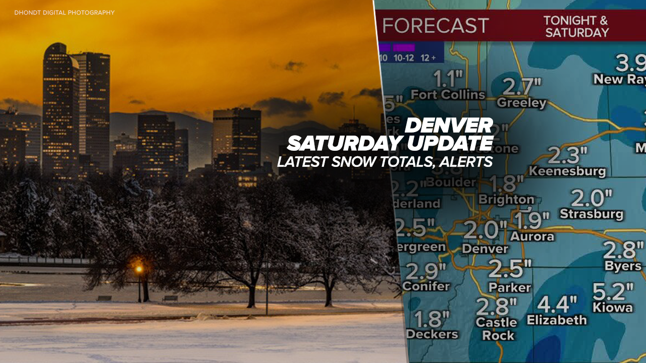
DENVER — The snow is tapering off along the Front Range but will continue into the evening hours for the Eastern Plains. The wet roads are expected to freeze this evening as road temperatures drop.
Saturday brought several inches of snow along the Front Range. The entire Denver metro area remains under a winter weather advisory.
Denver’s snow gauge out at DIA has reported 2.2 inches over the past 24 hours, according to the National Weather Service (NWS) in Boulder. But the brunt of the storm was seen in Weld County, where more than a foot of snow fell in the Greeley area Saturday.
Communities along the I-25 corridor, the Front Range stretching up to Fort Collins and portions of northeast Colorado are under the winter weather advisory until 11 p.m. Saturday for “additional snow accumulations up to 4 inches, with the heaviest snow falling across the southern Foothills and Denver metro,” said the NWS early Saturday morning.
Aurora, Golden, Boulder, Brighton, Lakewood, Loveland, Parker, Littleton, Arvada, among other areas are included in the winter weather advisory.
The NWS warned to watch out for the potential of slick spots on roads.
“By midday, expect wet roads with snow and cold conditions. By later in the day, slushy and sick in some of the Foothills locations and the mountains with snow showers continuing on the plains,” said Denver7 Chief Meteorologist Mike Nelson.
The good news: This weekend’s Denver snow storm is not a repeat of last Saturday’s heavy snow soaker.
“The low is too far to the south and weakening and too far to the south to be a huge storm,” added Nelson. “In the 2 to 4 inch range of snowfall for the Denver metro area, not a lot is coming for the mountains.”

Weather News
Colorado alpenglow: Here’s what makes some mountain sunrises, sunsets so magical
The NWS did add a winter storm warning to Colorado’s weather alert map for portions of Weld County, where heavy snow was possible with 1 to 5 inches of additional snow accumulation possible.
Eaton, Briggsdale, Grover, Fort Lupton and Greeley were included in the winter storm warning in effect until 11 p.m. Saturday.
Check latest Colorado winter weather alerts at this link.
“By this afternoon, snow should redevelop across most of the metro and portions of the plains as deeper moisture makes a brief return,” said the NWS in its weather discussion.
Those additional Colorado snow totals will help boost the seasonal cumulative average closer to normal in Denver.
The metro’s snow gauge stands at 14 inches behind the normal cumulative total heading into February.
At Denver International Airport, Denver’s official weather reporting station, 20.9 inches of snow has fallen this year compared to the normal of 34.9 inches.
To view the above Denver snowfall statistics infographics in fullscreen mode click this link.
More Denver metro weather, Colorado snow totals from the NWS:
- Greely: 13.5”
- Eaton: 8”
- Wheat Ridge: 6”
- Evans: 5.5”
- Genesee: 5.2”
- Arvada: 4”
- Thornton: 3.4”
- DIA: 2.2”
- Leadville: 1.2”
- Poudre Park: 1”
- Louisville: 0.4”
- Boulder: 0.2”
You can check the NWS Colorado snow totals map showing accumulations over the last 24 hours.
The system quickly pushes through the state and by Sunday, conditions clear out but it will remain cold.
Milder weather awaits for the beginning of the week with Denver’s temperature warming to 43 degrees on Monday. Day by day, afternoon high temps increase reaching the low 50s by Wednesday with Denver’s next snow chance arriving Friday.
“No big storms next week,” said Nelson.


DENVER WEATHER LINKS: Hourly forecast | Radars | Traffic | Weather Page | 24/7 Weather Stream
Click here to watch the Denver7 live weather stream.


