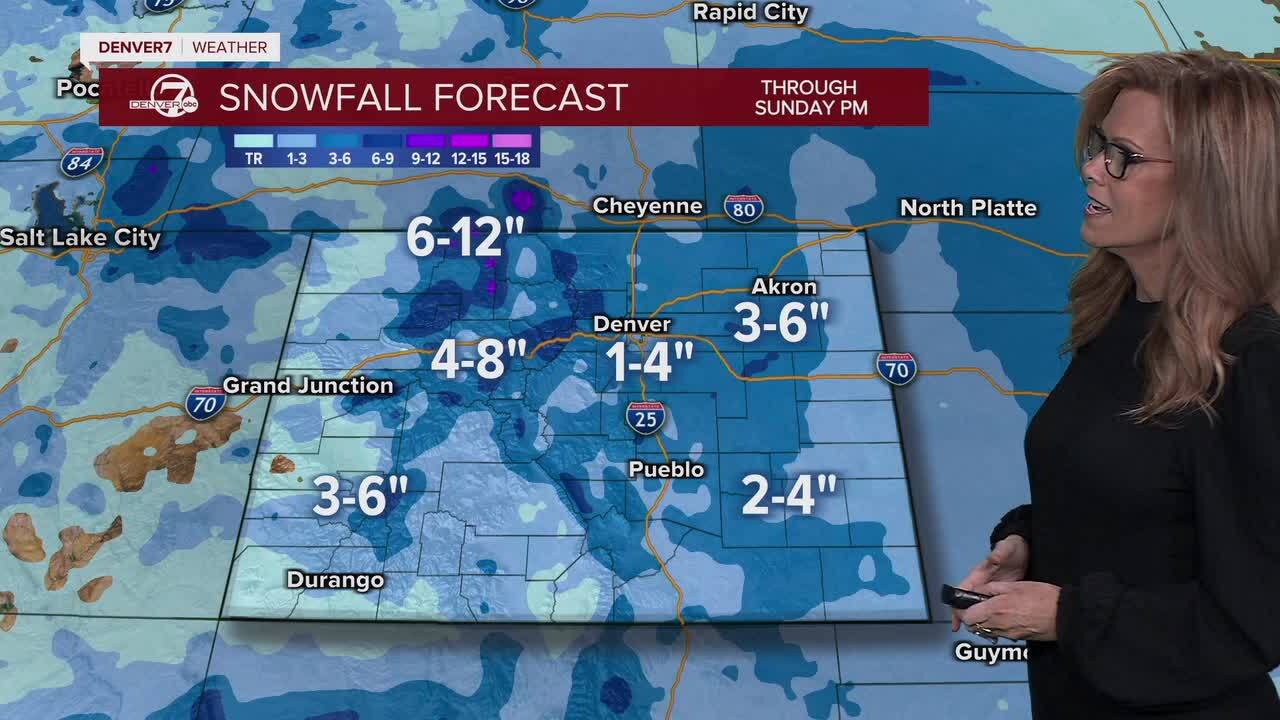
Areas of dense fog for the Front Range and eastern plains, snow and arctic air for the plains into Sunday morning.

Snow tapers off across the Front Range, with accumulations around 2-4 inches. The highest elevations to our west could see a foot of snow, with 4-8" expected in most areas through Sunday afternoon.

Winter Weather Advisories will be in effect along the northern and central mountains through Sunday afternoon. Look for 4 to 10 inches of new snow along with strong 50+ mph wind gusts!
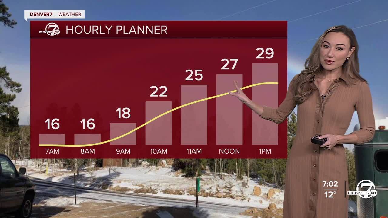
It'll be a cold day, with temperatures in the mid 20s at kickoff at the Broncos game, and only nearing 30 degrees for a high today.
We'll get a brief break from the snow Sunday into Monday afternoon before another system moves into the state. Look for light snow and chilly temperatures Monday night into Tuesday along the Front Range. Stay tuned for more details as the storm gets closer!
DENVER WEATHER LINKS: Hourly forecast | Radars | Traffic | Weather Page | 24/7 Weather Stream
Click here to watch the Denver7 live weather stream.


