


DENVER — Dangerous heat continued to impact Colorado through Sunday. Temperatures did skyrocket into record-setting territory again this afternoon.
This is an unprecedented stretch of 100+ degree days in Denver. On average, the city sees one 100-degree day each year.
Sunday's record high was 100-degrees, last set in 1878. We did officially hit 101 at DIA breaking the previous record of 100.
It doesn't look like we'll get any relief from the heat until Tuesday and Wednesday.
Highs Monday will not be as hot, but still well above normal, in the mid to upper 90s across the Denver. metro-area. There is a slight chance for scattered thunderstorms and showers in the afternoon.
By Tuesday, temperatures "dip" into the mid to upper 80s. It'll be the city's next best chance of rain. Any precipitation will be welcome, after this sizzling hot heat wave.
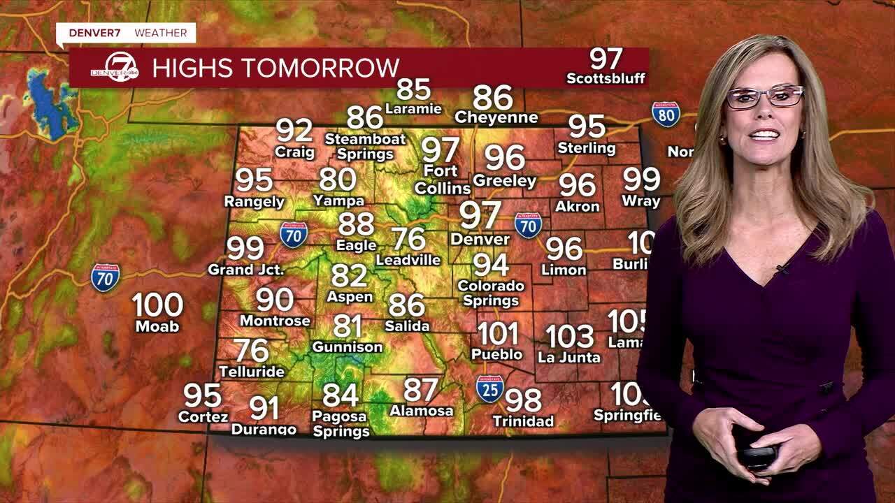
COLORADO HEAT WAVE | FORECAST TEMPS BY CITY
Here’s a look at how high temperatures are expected to peak through the weekend in these Colorado communities. To view the chart in fullscreen mode, click this link.
Denver7 live 24/7 weather stream
DENVER WEATHER LINKS: Hourly forecast | Radars | Traffic | Weather Page | 24/7 Weather Stream
Click here to watch the Denver7 live weather stream.
