DENVER — Look for mostly clear skies and cold temperatures across the Front Range tonight. Lows will dip into the teens in the mountains, and mid-20s around the Denver metro.
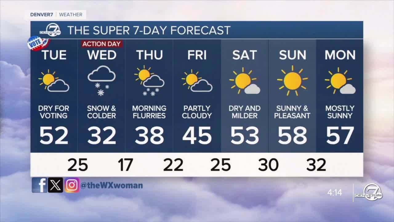
We'll get a brief lull Tuesday in between storms, but daytime highs will still be cooler in the low- to mid-50s in the city. It'll be dry though, so don't forget to get out and vote!
Meanwhile, a storm will be making its way across the state Tuesday. The mountains will start to the see the snowflakes fly midday Tuesday with the heaviest snowfall in the late afternoon/early evening along I-70.
This system's cold front will slide across the Denver metro Tuesday afternoon, dramatically dropping temperatures and kicking up the winds. Behind it, scattered rain showers will develop around dinnertime before quickly switching to snow.
The snow will linger overnight in the city, possibly bringing us the first official snowfall of the season. Snowfall amounts will be minimal in northern Colorado with the Denver metro area stacking up about 1 to 3 inches. Wednesday morning's commute could be icy, slow-going and slick. Stay tuned as we fine tune the snowfall forecast.
A Winter Storm Watch is in effect for the Southern Front Range Foothills and parts of the Palmer Divide in Douglas and Elbert counties from Tuesday afternoon until Wednesday afternoon. So far, it looks like 5 to 10 inches of new snow will stack up.
This storm clears out late Wednesday into Thursday morning. It'll be chilly Thursday with highs in the 30s in the metro. Look for mid-40s Friday with sunshine and 50s for the weekend!
DENVER WEATHER LINKS: Hourly forecast | Radars | Traffic | Weather Page | 24/7 Weather Stream
Click here to watch the Denver7 live weather stream.


