


DENVER — Saturday is going to feel more like summer than spring. Highs will be in the mid to upper 80s, and Denver might even break a record.
The record for the day is 85 degrees, we are forecasting 86 degrees at DIA. It’ll be dry, warm, and a bit breezy—especially near the foothills where wind gusts could hit 40 mph. If you’re heading into the mountains, expect it to be even windier with gusts up to 50 mph.
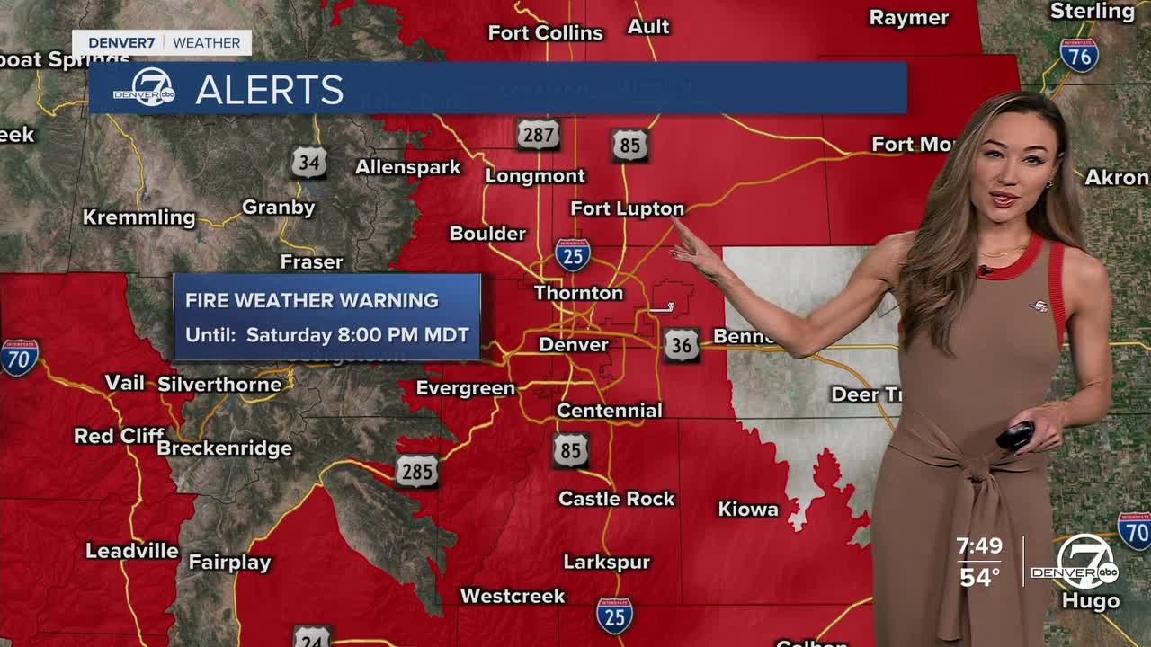
With all that heat and wind, fire danger will be high, so you'll want to and be cautious outdoors. A Red Flag Warning for high fire danger is in effect from noon until 8 p.m. Saturday.

Sunday brings a bit of a shakeup. A cold front will roll through early, dropping temperatures and cranking up the wind. Highs will only hit around 70 degrees, and you’ll notice that cooler air. We’ll also see some scattered rain showers later in the day and into the night. If it gets cold enough, there might be a mix of rain and snow in a few spots, but nothing that should cause any travel issues.
Monday cools off even more, with highs only in the upper 50s to near 60 degrees. There’s a slight chance of a few leftover showers early in the day, but things should dry out after that.
Beyond Monday, highs will mainly be in the 70s through the week. Classic spring flip-flop weather!
DENVER WEATHER LINKS: Hourly forecast | Radars | Traffic | Weather Page | 24/7 Weather Stream
Click here to watch the Denver7 live weather stream.
