


While Denver could see one or two gusty thunderstorms this evening, most of the metro area will stay dry. A few strong to severe-warned storms are possible over the northeastern plains, with the risk for some heavy rain and plenty of lightning. Most storms move out by 11 p.m. and clearing skies move in.
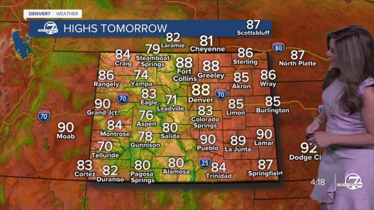
Sunny and drier conditions return statewide as the weather pattern shifts tomorrow. Expect mostly clear skies and warm temperatures, in the upper 80s across the Denver metro-area. Highs will be the mid- to upper-80s on the eastern plains and in the upper-60s to low- 70s in the higher elevations.
By Wednesday, it will be a bit warmer, but still dry. Daytime highs will skyrocket into the low 90s. A cold front is expected to move in on Thursday, which will drop temperatures by 8-10 degrees.
Looking further ahead, the overall trend suggests that the warm and dry conditions will continue into Labor Day weekend. With high pressure likely dominating, expect pleasant weather and no major storm systems on the horizon.
A few storms could pop up on Labor Day afternoon and evening. It's still a week away, so the forecast may change. Stay tuned!
DENVER WEATHER LINKS: Hourly forecast | Radars | Traffic | Weather Page | 24/7 Weather Stream
Click here to watch the Denver7 live weather stream.
