


Conditions in the mountains will remain slick early Sunday, especially on mountain passes, due to heavier snowfall rates at times. While a few showers are also possible in the northeast corner of the state, they are not expected to amount to much.
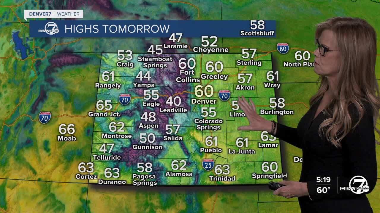
Looking ahead, dry weather is expected Monday through Thursday, with above-normal temperatures for much of Colorado. The wind will die down, and we will enjoy sunshine for our Sunday afternoon. It will be a bit cooler tomorrow, though, with highs slightly below today’s warmth. The dry and pleasant weather will continue for the next few days, making for good outdoor conditions across the plains and foothills. Afternoon highs on Thursday and Friday will reach record territory with temperatures near 80 degrees.
By Friday night, things will begin to change. A cooler trend is expected, with a chance of precipitation in the forecast for both Friday night and Saturday. While the moisture won’t be heavy, there is a potential for some showers or light snow in the mountains and foothills. It will also feel a bit cooler than earlier in the week, with temperatures closer to seasonal averages.
For the long-term forecast, Monday and Tuesday will bring mild temperatures, with highs in the upper 60s to low 70s across the plains. The weather should remain dry, with just some high-level clouds passing through. However, by the end of the week, a weak cold front could bring a slight dip in temperatures, and there may be a small chance of precipitation Friday and Saturday. Overall, expect a mix of sunshine and clouds with temperatures cooling back to normal by the weekend.
DENVER WEATHER LINKS: Hourly forecast | Radars | Traffic | Weather Page | 24/7 Weather Stream
Click here to watch the Denver7 live weather stream.
