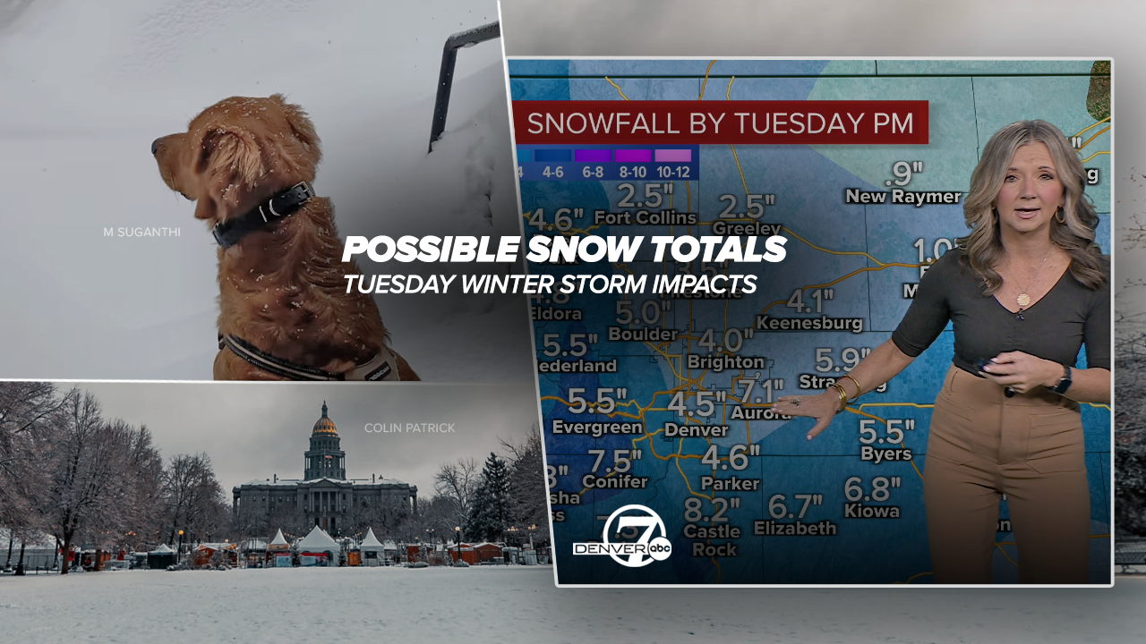
DENVER – If you missed out on the weekend snow in Colorado, a better shot at accumulation is in Denver’s weather forecast for Tuesday and unfortunately the morning commute could be a little dicey in some parts of the metro.
“We do have some decent snow on the way, it’s going to make for a slick and slow commute tomorrow morning,” said Denver7 chief meteorologist Lisa Hidalgo. “Likely around 2 to 6 inches for portions of the Denver metro area. We may get a few pockets along the Palmer Divide, part of Douglas and Jefferson Counties could see upwards of around 6 to 8 inches.”
Winter weather advisories will go into effect starting Monday for a large swath of the I-25 corridor stretching from the Wyoming border and Fort Collins through the Denver metro down to Castle Rock and Pueblo.
Check latest Colorado winter weather alerts | Updated list of closings/delays
Motorists should keep an eye out for slick conditions, particularly on bridges and overpasses.
“Snow will create hazardous travel conditions tonight through the Tuesday morning commute. While it won't be a heavy snow, a few inches will accumulate across the Front Range I-25 Corridor, Palmer Divide, and adjacent plains,” wrote National Weather Service (NWS) forecasters in Boulder.

Snowfall timing in Colorado
The I-70 mountain areas will first see the snow between noon and 6 p.m. on Monday before flurries begin to push into the metro area.
“Past sunset on Monday, you’re looking at a chance for some of that snow to develop first near spots like Longmont and Fort Collins and light snow in Denver until the overnight hours,” added Hidalgo.
Snowfall rates between midnight and noon on Tuesday in Denver could pick up to around 1 inch per hour, according to the NWS.
“Tomorrow morning we’re going to see some of that sticking to the ground, so for the early morning commute - that’s when the brunt of that snow is going to fall, so timing-wise it’s not great," said Hidalgo. "For the afternoon commute Tuesday, conditions gradually clear out from north to south."

Colorado, Denver metro potential snow totals through Tuesday
- Arvada: 4.0”
- Aurora: 5.0”
- Boulder 3.4”
- Brighton: 4.0”
- Broomfield: 4.0”
- Castle Rock: 5.6”
- Centennial: 4.0”
- Copper Mountain: 2.0
- Denver: 3.2"
- Estes Park: 3.7”
- Fort Collins: 2.4”
- Fort Morgan .8”
- Greeley: 1.6”
- Golden: 6.0”
- Highlands Ranch: 4.0”
- Lakewood: 5.0”
- Limon: 4.1”
- Longmont: 3.1”
- Loveland: 3.2"
- Parker: 5.0”
- Winter Park: 2.2”
The above snowfall estimates (as of 3:30 p.m. Monday) are a combination of Denver7 and NWS data. You can check the NWS' probabilistic snow forecast tool at this link.

Along with the snowfall, temperatures will plunge into the single digits for morning lows early Wednesday morning as afternoon high temps in Denver will struggle to reach the mid 30s through the rest of the week.Tuesday’s high temperature in Denver is forecast at only 27 degrees.

Weather News
Where to seek shelter from the cold across the Denver metro due to frigid temps
As of Monday morning, no school delays or cancellations were reported in the Denver metro area, but stay tuned to Denver7 for any impacts to classes.
“Looking at around 2 to 6 inches of snow, it’s great for the drought conditions but it is going to make the drive Tuesday morning slow and slick,” said Hidalgo. “We’ll have to see how that plays out for the kids who are heading back to school Tuesday after a long holiday break. We may see some late starts.”


DENVER WEATHER LINKS: Hourly forecast | Radars | Traffic | Weather Page | 24/7 Weather Stream
Click here to watch the Denver7 live weather stream.


