

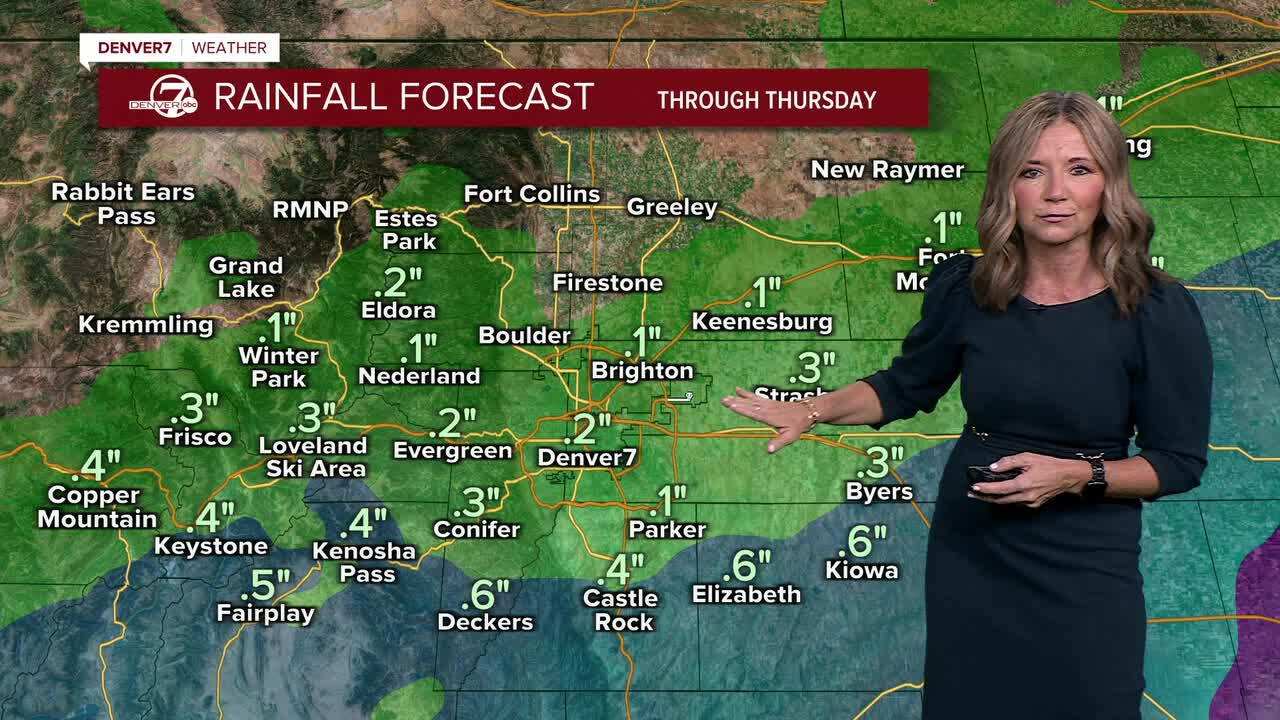


It's a cloudy and cool start to our Wednesday and there's some heavy rain falling across southern Colorado!
The rain (and mountain snow) that we're seeing today is due to two things...a powerful upper-level low that's spinning in from the southwest and the moisture from the remnants of Hurricane Polo. That combination will pull a surge of deep moisture into Colorado today and into early Thursday morning.
Watch Denver7 Chief Meteorologist Lisa Hidalgo's forecast video below:
The rain will spread north throughout the day, with more showers possible across the Denver metro area by late morning and early afternoon. Right now, it looks like the storm is going to spin a little too far to the south for any heavy rain near Denver. It will be even drier to the north near Fort Collins and Greeley. It looks like the core of the Metro Area will pick up around a quarter to a half an inch of rain, with some heavier totals south along the Palmer Divide.
The Flood Watch covers far southeastern Elbert County and southern Lincoln County along with the majority of southern and eastern Colorado. It will stay in effect until noon Thursday as up to three to four inches of rainfall is still possible in these areas.
Rain will linger across the eastern plains through early Thursday, with gradual clearing by midday. We'll see plenty of sunshine by tomorrow afternoon and temperatures will climb into the upper 60s to low 70s.
Gorgeous weather will settle in for the weekend as a ridge of high pressure builds over the Rockies. We'll see lots of sunshine from Friday through the weekend, with highs in the upper 70s!
DENVER WEATHER LINKS: Hourly forecast | Radars | Traffic | Weather Page | 24/7 Weather Stream
Click here to watch the Denver7 live weather stream.
