April weather is wild in Colorado because we can get all four seasons – sometimes all on the same day.
It really is the start of severe weather season, with the potential for hail and even tornadoes, but the plains can still get some big snowstorms and certainly the mountains get plenty of snow, especially right along the Front Range, where we see some of our biggest snows of the season.
April stats
- The wettest April goes back to 1900, when 8.24 inches of liquid fell.
- The driest was in 1963, with just 0.03 inches.
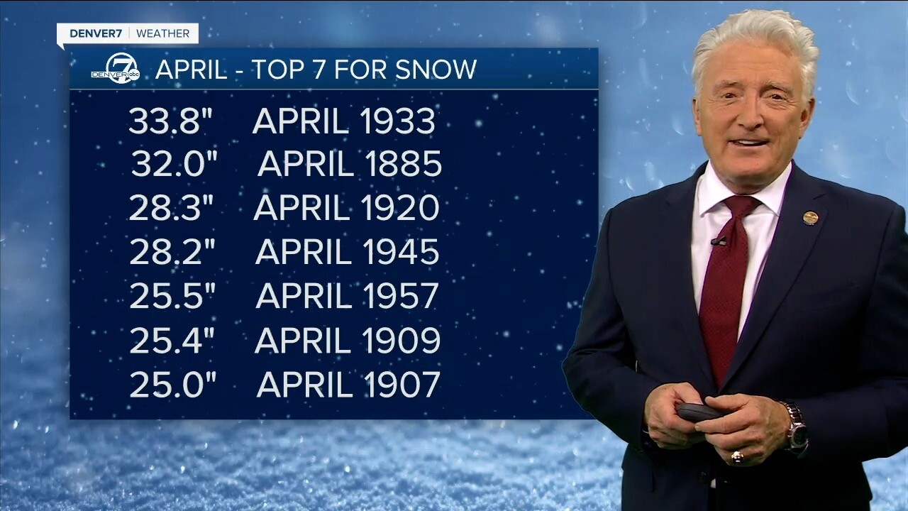
- The snowiest April came in 1933, when 33.8 inches fell.
- Average April snowfall is about 8.8 inches.


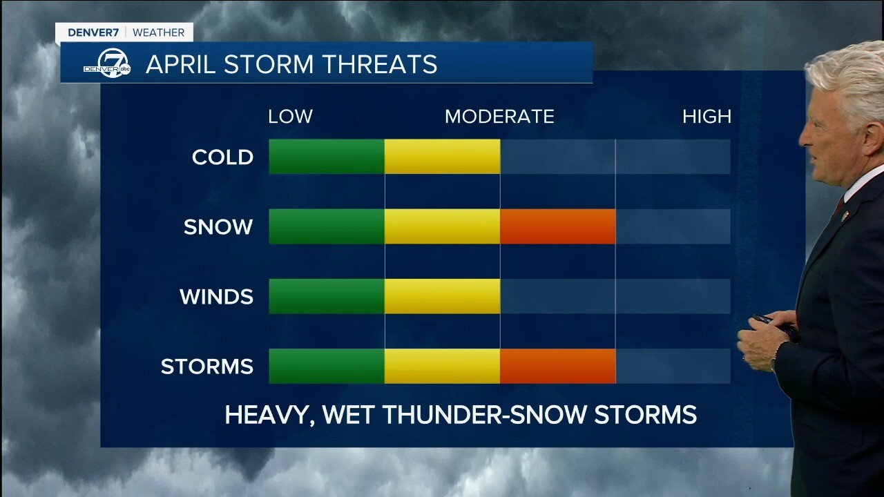
April storm threats
We can still get some cold in Colorado in April, but it becomes less of a threat. Heavy snow is certainly possible in April, but it is really the winds and thunderstorms – and sometimes even thundersnow! – that pose the main threats.


Spring upslope storms
The classic April storm in Colorado is the upslope storm, in which winds from the south and east of Denver force moisture up against the mountains just the west or southwest of town.
Winds swirl counterclockwise around the front, called a “low,” dumping snow on Denver. And that’s what’s interesting about these storms: The heaviest snow often falls along and east of the Continental Divide. Ski areas closer to town like Eldora, Loveland and Arapahoe Basin are often the beneficiaries.
Ahead of the front to the east is where the severe thunderstorms and rain happen. Western Colorado, meanwhile, will oftentimes have sunshine at the same time.
So, you can have a very different weather pattern across the state.


El Niño gives way to La Niña
Alright, let's look ahead at what's going to happen.
El Niño, which is the warmer water in the Pacific, has been weakening recently. We didn't have much in the way of Arctic outbreaks this winter season, just that one in January. That's because we tend to get a split flow in the jet stream with an El Niño.
Now we're going to what we call a La Niña, which is the cooler water that tends to bring more of a jet stream coming in from the northwest to the southeast. If this was wintertime, that would mean more likely to get some good cold waves, but, because we're in the springtime now, it's going to bring in cold fronts from the northwest that can mean more active severe weather in April, May and June.
So I think we're gonna have an active severe weather season coming our way.


Longterm outlook: Other spring weather headlines
As far as the current drought index, there's no drought across the central and northeastern part of the state, while we’re still in moderate drought down to the south and west and severe in the Midwest.
The 90-day outlook right now is calling for warmer-than-average temperatures for much of the nation, with Colorado kind of in between the main pockets of really warmer weather. It is expected to be slightly drier to the southwest but wetter over the northeast, which coincides with that northwest-southeast jet stream flow that could bring cold fronts that bring more of that severe weather as we move into the spring and early summer.


The climate change connection:
Springtime has been getting warmer with climate change. Data from Climate Central shows that the average temperature has warmed four degrees across much of western Colorado and as much as five degrees through a large swath of the southwestern U.S. since 1970. In the video player above, Denver7 Chief Meteorologist Mike Nelson breaks down the warming of the earth and its impact on our weather patterns.
DENVER WEATHER LINKS: Hourly forecast | Radars | Traffic | Weather Page | 24/7 Weather Stream
Click here to watch the Denver7 live weather stream.


