


What a Wednesday! This mild and dry weather pattern continues through Thursday afternoon, so get outside and enjoy the sunshine while it's here!
We'll kick off your Thursday with plenty of sunshine as temperatures skyrocket in to the upper 60s to low 70s along the northeastern plains. The warm, dry and windy conditions will bring high fire danger for some areas ahead of our next storm. Red Flag Warnings will go into effect at noon Thursday until 8pm across southern and eastern Colorado for 40 mph wind and humidity values as low as 10 percent.
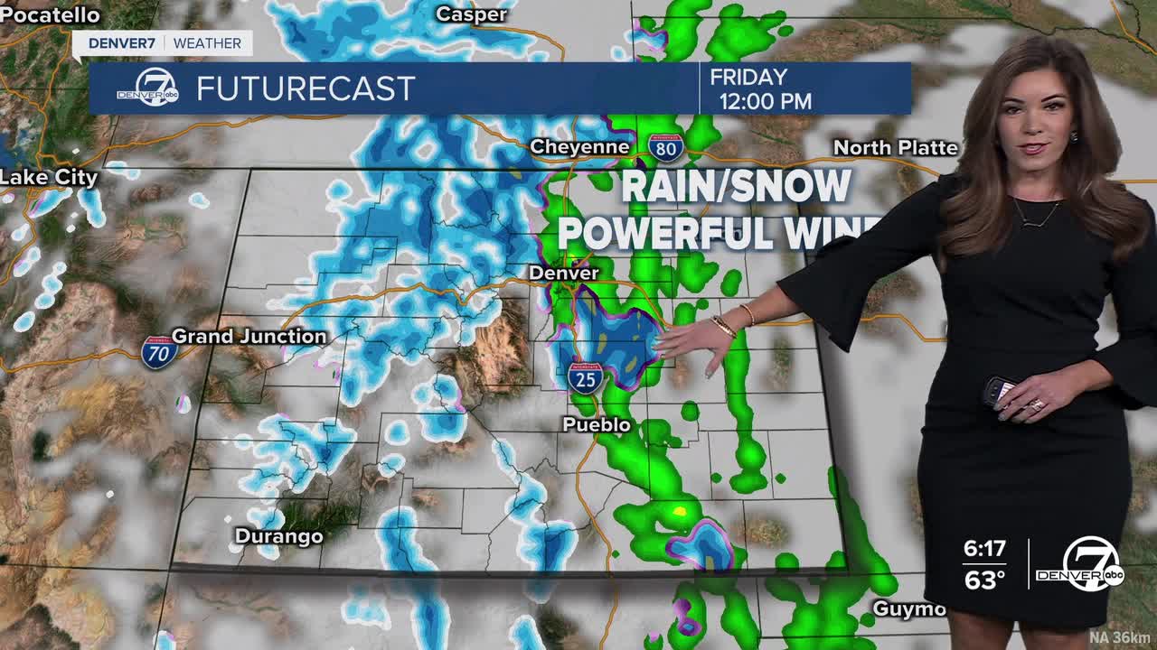
Wintry changes roll into the state Thursday night into Friday. A fast-moving storm system will bring heavy mountain snow, a wintry mix to the metro and very strong winds to much of the state. Wind gusts could exceed 60 mph in southern Colorado and along the Eastern Plains. It'll be a very tricky traveling day with such blustery conditions, so avoid I-70 and I-76 if you can.
So far, it doesn't look like the Denver metro will see much snow from this storm. The city will get a brief rain/snow mix and much cooler temperatures to end the work week.
It will stay chilly and blustery on Saturday, with highs in the 40s. We'll also see a chance of light snow across the plains Saturday afternoon.
Skies will then clear and temperatures will climb for the second half of the weekend. Temperatures will rebound in to the lower 60s on Sunday and back into the lower 70s on Monday for St. Patrick's Day.
DENVER WEATHER LINKS: Hourly forecast | Radars | Traffic | Weather Page | 24/7 Weather Stream
Click here to watch the Denver7 live weather stream.
