DENVER — It's a big temperature plunge as a classic springtime winter storm moves across Colorado dumping snow in the mountains bringing light snow in the Denver metro area Thursday.
The changing conditions could impact the Thursday morning and afternoon commute.
Awinter weather advisory went into effect at 3 p.m. Wednesday for mountain communities, including in Rocky Mountain National park, for possible snow accumulations between 4 and 8 inches with wind gusts up to 40 mph possible, according to the National Weather Service Office in Boulder.
A winter weather advisory is also in effect for Rabbit Ears Pass where the heaviest snow will fall Wednesday afternoon and evening, the NWS said.
Checkother areas includedin the winter weather advisory and the latest weather alertson this Denver7 Weather Action Day.

DENVER METRO AND FRONT RANGE TIMELINE
It's quite the juxtaposition from Wednesday’s high temperatures around 70 degrees. Starting in the evening, rain showers developed before switching over to light snow overnight.
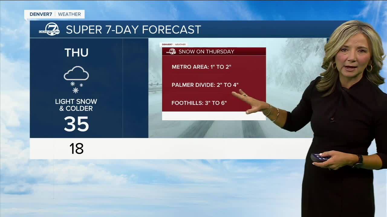
“By early Thursday, 1 to 2 inches is possible for Denver and the I-25 corridor. We could see around 2 to 4 inches south of Denver along the Palmer Divide” said Lisa Hidalgo, Denver7 morning meteorologist.
While light snow is only expected in the Denver metro and Front Range, there could still be travel impacts slushy, wet conditions on roadways.
Denver’s hourly temperatures stayed in the 60s until around sunset Wednesday before the big plunge moved in.
With the rain-snow mix arriving overnight, temperatures have fallen to the 30s and only warm up to around 40 degrees. With the winds as a factor, it will feel like temperatures are only in the 20s on Thursday.

Windy and cold conditions will remain in Denver as Friday’s high will reach 40 degrees with Saturday and Sunday warming only into the low 40s. Looking ahead, a light rain and snow mix is possible on Sunday and Denver7 weather will update the latest timing and forecast as we get closer to the weekend.
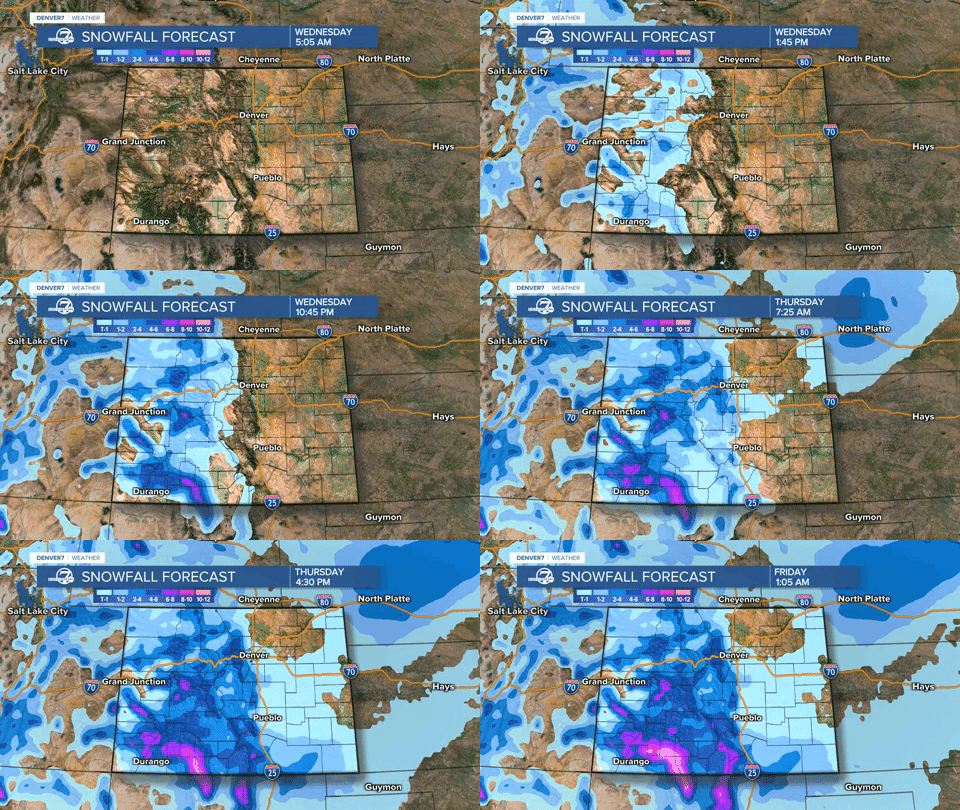
Recapping for the mountains, a winter weather advisory goes into effect with short bursts of heavy snow possible, according to the NWS. Travel impacts in the mountains will worsen Wednesday afternoon and evening with lighter snow overnight into Thursday morning for the plains.
Heavy snow in the mountains continues to help Colorado’s drought conditions. A look at the 2-day snow total forecast shows 10 to 20 inches accumulation in the Elkhead and Park Mountains in the state’s northeast region. The Sawatch Mountains can also expect up to 20 inches above 10,000 feet. Colorado’s San Juans will see up to 2 feet of snow with this storm system.

MARCH WEATHER IN COLORADO
While March is typically the snowiest month of the season, officially at DIA, only a trace of snow has fallen this month. Before Thursday’s snow arrives, Denver has officially seen 46.4” of snow for the 2022-2023 season, which is still above last year’s totals so far.
Average March snowfallfor Denver is 11.5 inches.
As for temperatures in March, the average low starts out the month at 23 degrees and ends March 31 at 31 degrees.

And despite the recent warm days, Denver’s average high temperature starts the month at 50 degrees but warms 10 degrees over the course of March.
The warmest temperature on record for March was 84 degrees on March 26, 1971. Check out Denver7's in-depth, interactive look at March weather loaded with charts and graphs. If you have trouble viewing, check it out fullscreen.
MORE: Closings and Delays | Latest forecast | Radars | Traffic | Weather Page | 24/7 Weather Stream

You can always watch 24/7 weather, radar and news updates on the free Denver7+ app on your TV.


