


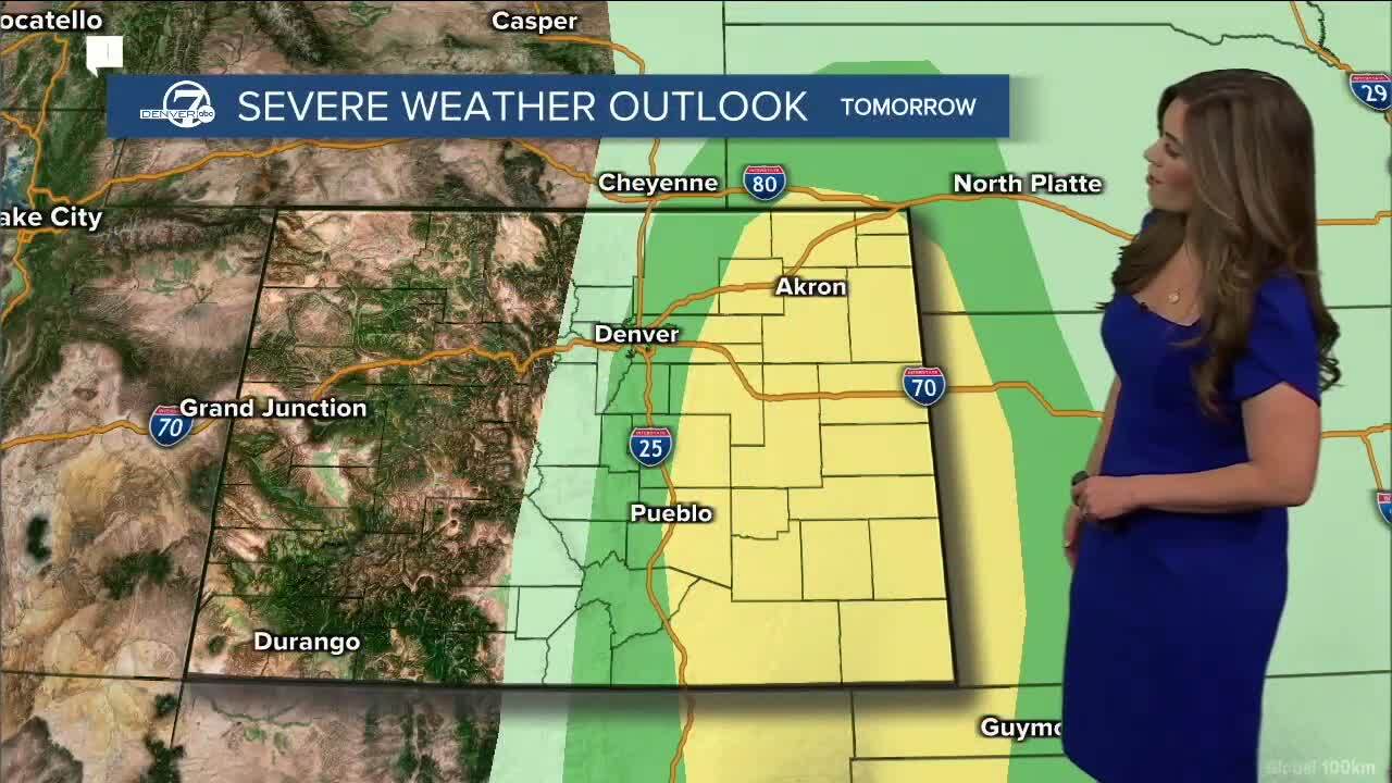
The Denver metro and Colorado’s eastern plains could be in store for more afternoon storms to round out the week, including a chance of severe storms as far west as Denver and Fort Collins Friday afternoon.
Clouds will move in over Denver around 1 p.m. Thursday, with rain developing along the I-25 corridor by 2 to 3 p.m., according to Denver7 meteorologist Lisa Hidalgo.
Southeastern Colorado could see stronger storms into the evening.
The severe risk is low in town Thursday, with rain and thunderstorms the main threat in the metro. The eastern plains are under a marginal risk for severe weather with hail being the main threat, according to the National Weather Service in Boulder.
The southeast corner of the state is under a slight risk for severe storms. The biggest threats will be ping pong ball sized hail, damaging 70+ mph gusts and isolated landspout tornadoes, according to Denver7 meteorologist Danielle Grant.
Another round of storms is expected to move through northern Colorado and Weld County after midnight, and could linger into the overnight and early morning hours Friday. Small hail and 45 mph wind gusts are possible with those storms.

Highs will be in the upper 70s in the metro and along much of the plains on Thursday, with a high near 80 expected out east near Burlington. Temps will climb into the mid- to upper-80s to the southeast.
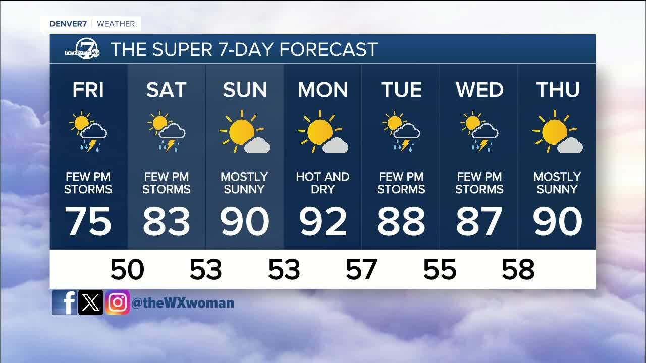
Scattered afternoon storms likely return on Friday, with a chance that some storms could turn severe.
“Ingredients would be favorable for a few severe storms late [Friday] afternoon and evening,” the NWS said in its Thursday forecast discussion, adding that the severe threat could extend as far west as Denver and Fort Collins depending on cloud behavior.
We’ll again be in the mid-70s on Friday.
Saturday brings with it more chances for a few afternoon showers before hot and sunny weather arrives Sunday. Highs climb to the upper 80s on Sunday.
As of Thursday, Hidalgo’s forecast indicates we’ll flirt with record highs on Monday as temps climb into the 90s.
The record high for June 3 is 94 degrees, set back in 2006. Grant was calling for a high of 92, which is well above normal for the beginning of June.

DENVER WEATHER LINKS: Hourly forecast | Radars | Traffic | Weather Page | 24/7 Weather Stream
Click here to watch the Denver7 live weather stream.