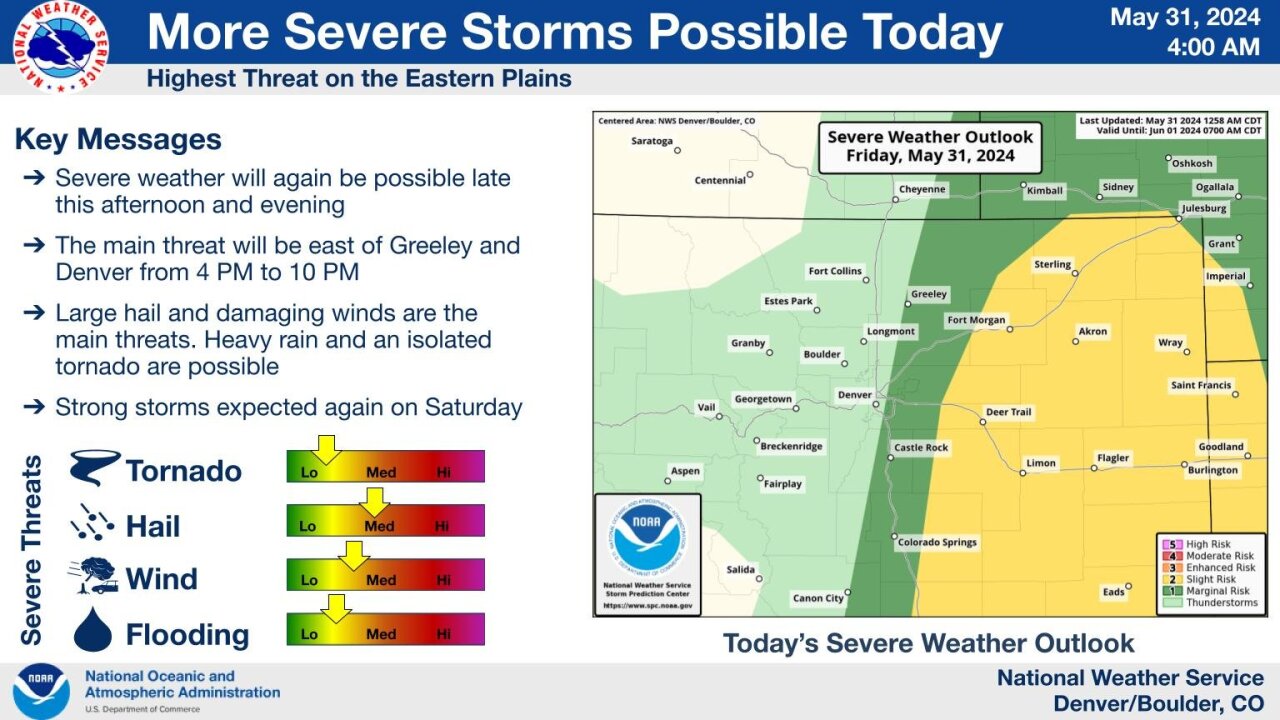
DENVER — Severe thunderstorms are likely to bring large hail again for the I-25 corridor starting late Friday afternoon and into the late evening hours, according to weather forecasters with the National Weather Service.
The main threat for severe weather is east of Greeley, Denver and Castle Rock starting from about 4 p.m. all the way to about 10 o’clock this evening, National Weather Service (NWS) officials in Boulder said on X, formerly Twitter.
“Severe thunderstorms are expected to develop by late afternoon, initially across northeast New Mexico and eastern Colorado, and possibly far southeast Wyoming. A Severe Thunderstorm Watch is likely for at least parts of the region,” NWS officials with the Storm Prediction Center said in their latest forecast discussion.
“A few supercells are possible with large hail being the primary threat again,” weather officials in Boulder said earlier Friday. “Large hail and damaging winds are the main threats, with heavy rain and isolated a tornado possible.”

In their forecast discussion, NWS forecasters in Boulder said winds could end up pushing the severe weather threat northward as we head into the evening hours, spreading it toward the I-76 corridor, though the highest chance of anything severe happening “would still be over the Palmer Divide to limon and perhaps as far north as Akron.”
Officials at the Storm Prediction Center projected a 60% chance of issuing a severe thunderstorm watch for the Denver metro area and parts of eastern Colorado by about 3:30 p.m. Friday.
DENVER WEATHER LINKS: Hourly forecast | Radars | Traffic | Weather Page | 24/7 Weather Stream
Click here to watch the Denver7 live weather stream.


