


DENVER — The National Weather Service Goodland confirmed an EF0 touched down in Vona, Colorado, on Tuesday.
The NWS surveyed the damage and determined the tornado touched down at approximately 4:30 p.m. and stayed on the ground for about 10 minutes. It’s estimated the peak wind was 80 mph, and it traveled for a little over 20 miles.
Damage included:
- A garage without anchor bolts on part of the structure shifted about 6 inches east off the foundation.
- A communications tower folded in half.
- Some roof and siding damage was scattered in the area.
- A playground set was ripped apart.
- A trampoline crumbled and flew off to the northeast.
ABC News obtained video from Jeffrey Ryan Boettge that shows the tornado forming as he was driving by.
The Kit Carson County Sheriff’s Office said there was a second tornado north of Stratton, though the NWS has not yet confirmed that. The sheriff’s office confirmed there have been no reported injuries. Multiple tornado warnings were issued Tuesday evening.
The heavy rain also led to flooding on I-70, forcing a brief closure in the Wheat Ridge area last night, according to the Wheat Ridge Police Department.
Current road closures due to heavy rain/flooding: I-70 EB on-ramp at Wads, I-70 EB one lane after Kipling, EB W 44th Ave at Wads. pic.twitter.com/641uC1Uv9r
— Wheat Ridge Police (@WheatRidgePD) July 27, 2022
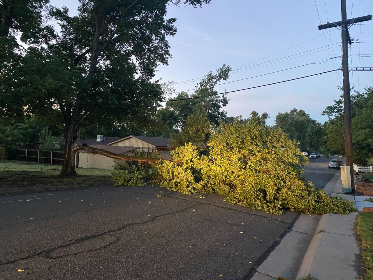
The conditions also caused a large tree limb to break off and block Newland Street at 46th Place, police said. The City of Wheat Ridge Public Works will remove the tree limb at some point Wednesday.
NWS Boulder said the heaviest rain in the Denver metro area was mainly west of I-25. One to 2 inches of rain fell in just 30 minutes in some places.
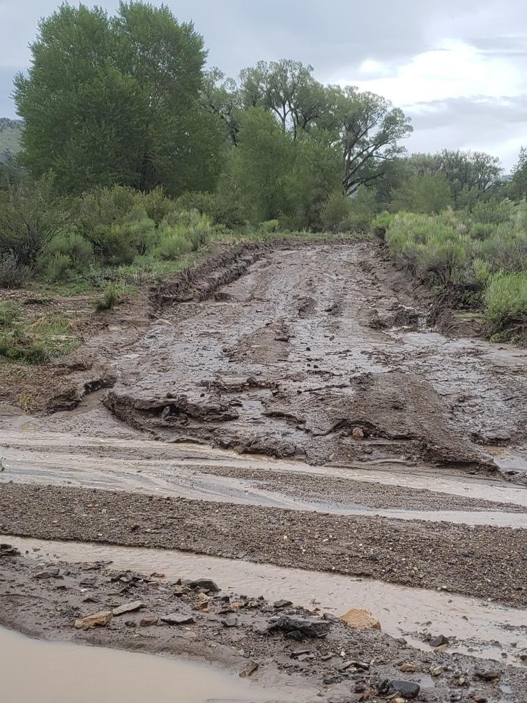
The rain also caused a mudslide on Forest System Road 655 near the intersection of Forest System Road 644 in the Rio Grande National Forest, That road and Forest Service 521 to Regan Lake are both impassable.
Spinney Mountain State Park is also closed Wednesday because of road damage from flash flooding, according to Colorado Parks and Wildlife. The repairs can be completed in one day, CPW said.
Red Mountain Pass also closed for more than three hours because of a significant mudslide, according to the Colorado Department of Transportation. Crews had to use heavy equipment to clear 3 feet of mud and debris, like dead trees, limbs and boulders. The road reopened around 6:30 p.m. Tuesday.
County Road R, which is a back road from San Luis to Cañon, washed out last night as well, according to the Costilla County Office of Emergency Management.
It's expected to be drier around the Denver metro area Wednesday afternoon, though there is a chance for storms. Some severe weather is possible in other parts of the state. A flood watch is in effect for southwest Colorado from 12 p.m. to 12 a.m. The NWS Boulder Storm Prediction Center has the northeast corner of the state under a marginal risk for severe thunderstorms, which could include hail, gusty winds and heavy rain.
Storm Prediction Center has the NE Corner in Marginal and Slight Risk for severe thunderstorms. Main Threats include; Hail, Gusty Winds, and Heavy Rain. Most of the state is under the General thunderstorm risk. #cowx pic.twitter.com/X4XU8L2Cts
— NWS Boulder (@NWSBoulder) July 27, 2022