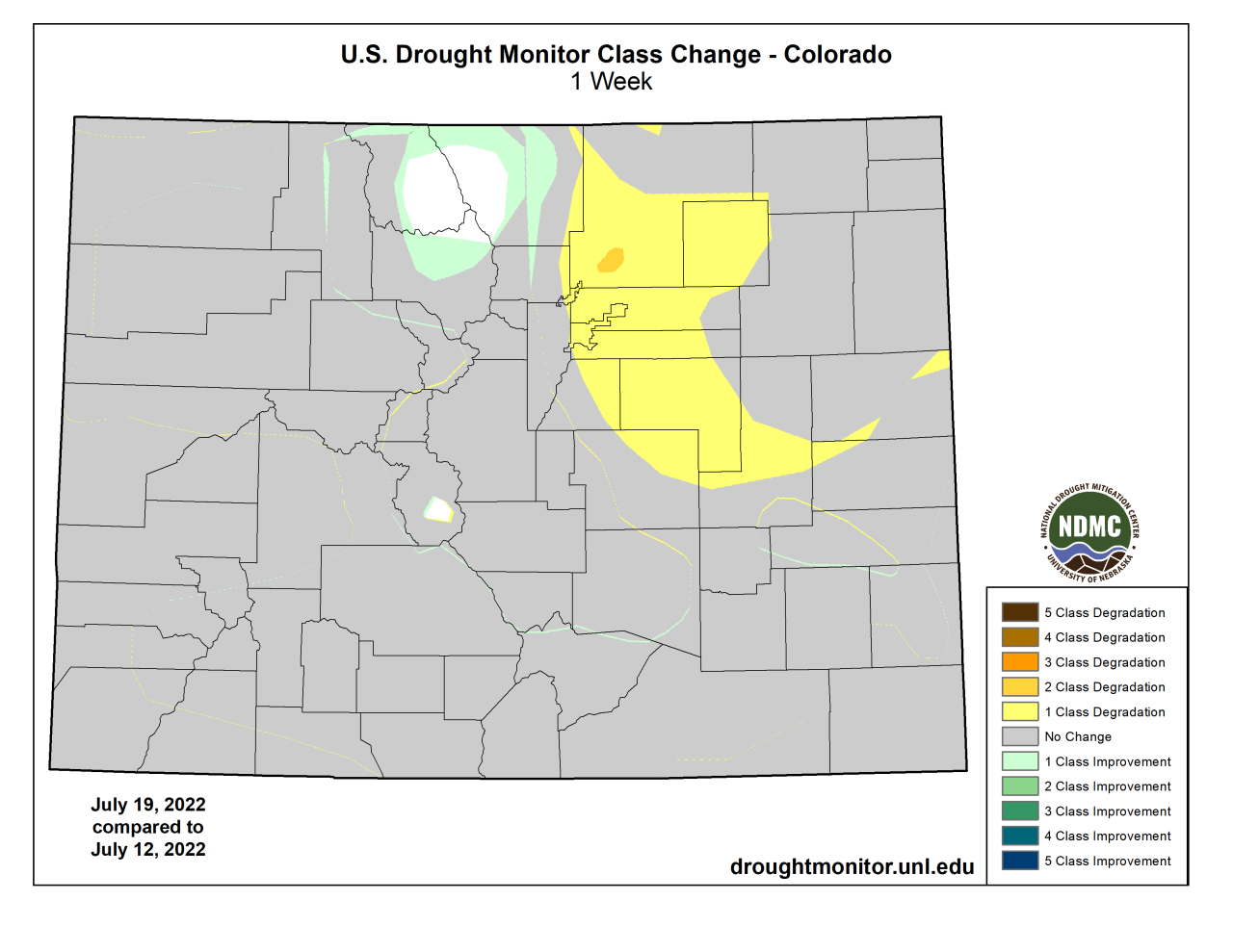
DENVER – Much of the Denver metro area moved back into the severe drought category over the past week despite some monsoon precipitation, according to the weekly report from the U.S. Drought Monitor.
Most of the rest of the state was relatively unchanged in terms of drought. But Denver, Douglas, Elbert, Arapahoe, Adams and Weld counties moved back to severe drought conditions for the first time since May.
The area had mostly been in moderate drought for the past two months.
Though the metro area and eastern plains have seen monsoon pattern storms and other thunderstorms over the past few weeks somewhat regularly, Denver International Airport has gotten less than half of its normal precipitationfor July so far.

The airport, where official measurements are taken, has received 0.56 inches so far this month, compared to 1.37 by this time in a normal July, according to National Weather Service data. Denver is now more than 2 inches of precipitation behind normal, at 6.68 inches compared to 8.8 inches.
The only other slight changes in terms of drought were areas of Larimer, Jackson and Grand counties moving to abnormally dry from being drought free.
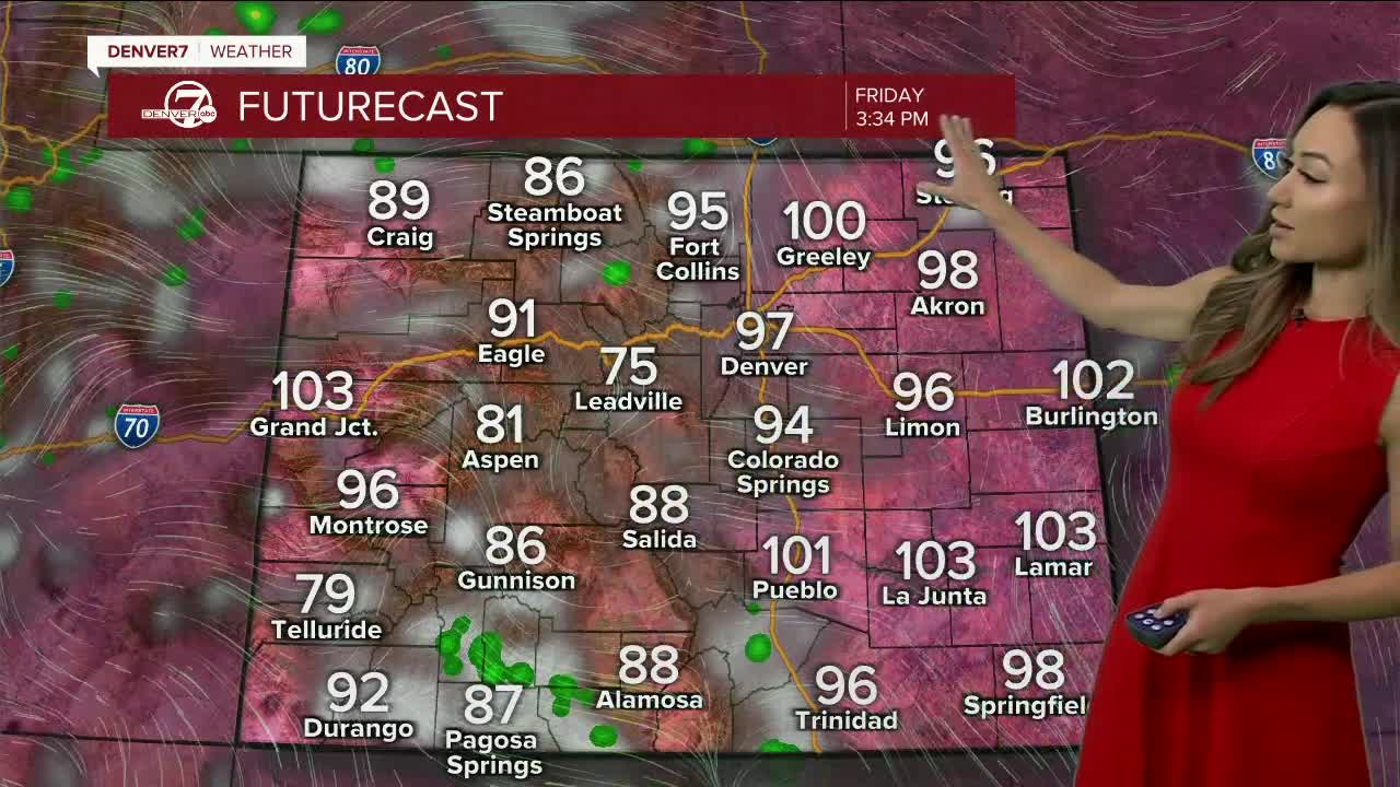
The metro area and plains are expected to see two more days after Thursday of temperatures in the upper-90s and triple digits. But high temperatures on Sunday and Monday are forecast to be in the upper 80s, with a chance of rain and storms on Sunday in Denver.
But a heat advisory is in effect from 10 a.m. to 8 p.m. from the foothills of Douglas County, north to the border with Wyoming, and east to the Kansas border, except for Yuma County.
The National Oceanic and Atmospheric Administration (NOAA) held a webinar Thursday with Western climate, drought, and wildfire experts to discuss current conditions and the forecast for the next few months.
Dr. David Simeral, an associate research assistant of climatology at the Desert Research Institute at the Western Regional Climate Center and a U.S. Drought Monitor author, said 87% of the Intermountain West region was in drought and said the snowpack in Colorado saw an early melt-out for the third year in a row.
He explained how late season dust events put a darker layer on top of the snowpack, which holds more heat than the reflective snow and leads to faster melting and earlier runoff. He also showed maps showing some above-normal precipitation from the monsoon season on the western side of Colorado and some vegetation health improvement in that same area.
Jon Gottschalck, the head of forecast operations at the National Weather Service and Climate Prediction Center, said drought is expected to persist for the next couple of months in Colorado, and La Niña is expected to continue through the rest of the calendar year, with above-normal mean temperatures most likely in the central Rocky Mountains.
John Balbus, the interim director of the Office of Climate Change and Health Equity within the Office of the Assistant Secretary for Health, said 26 Colorado counties are on track to have more than five heat exceedance days in July that could put people at risk.
Jim Wallmann, a senior predictive services forecaster with the NWS and U.S. Forest Service, said Colorado has low risk for major fires over the next few weeks and an above-normal potential for far northeastern Colorado in August. The current forecast for Colorado shows no “major” significant wildfire threat in Colorado into September.
In terms of the West’s worst megadrought in 1,200 years, the scientists said projections are not showing any major changes in the near future.
“If the past two decades-plus is an indicator of what’s ahead, it’s looking like we are in the middle of the megadrought and the situation could possibly be continuing for some time into the future,” Simeral said.


